
Caution: 10 - 12 hour day minimum. Full Sun. No Water.
Note: Hook Canyon makes an excellent exit strategy for Mount Majestic and Cathedral Mountain, but do not hike this route merely for the canyon experience.
Disclaimers completed. To be truthful, I have wanted to do this route for two years. It just looks incredible, rugged summit ascents with thousands of vertical feet; what's not to love. In 2012 when first reviewing the route, I didn't feel comfortable with a solo attempt. I love to scramble, whereas canyoneering, not so much. In 2013, I had made plans for a shot at the summit, but the weather never seemed to cooperate, and 2013 went down in the record books as the wettest summer since 1948. 2014 was the year, and finally, the days were getting long enough, and the temperature stayed cool enough to do the climb.
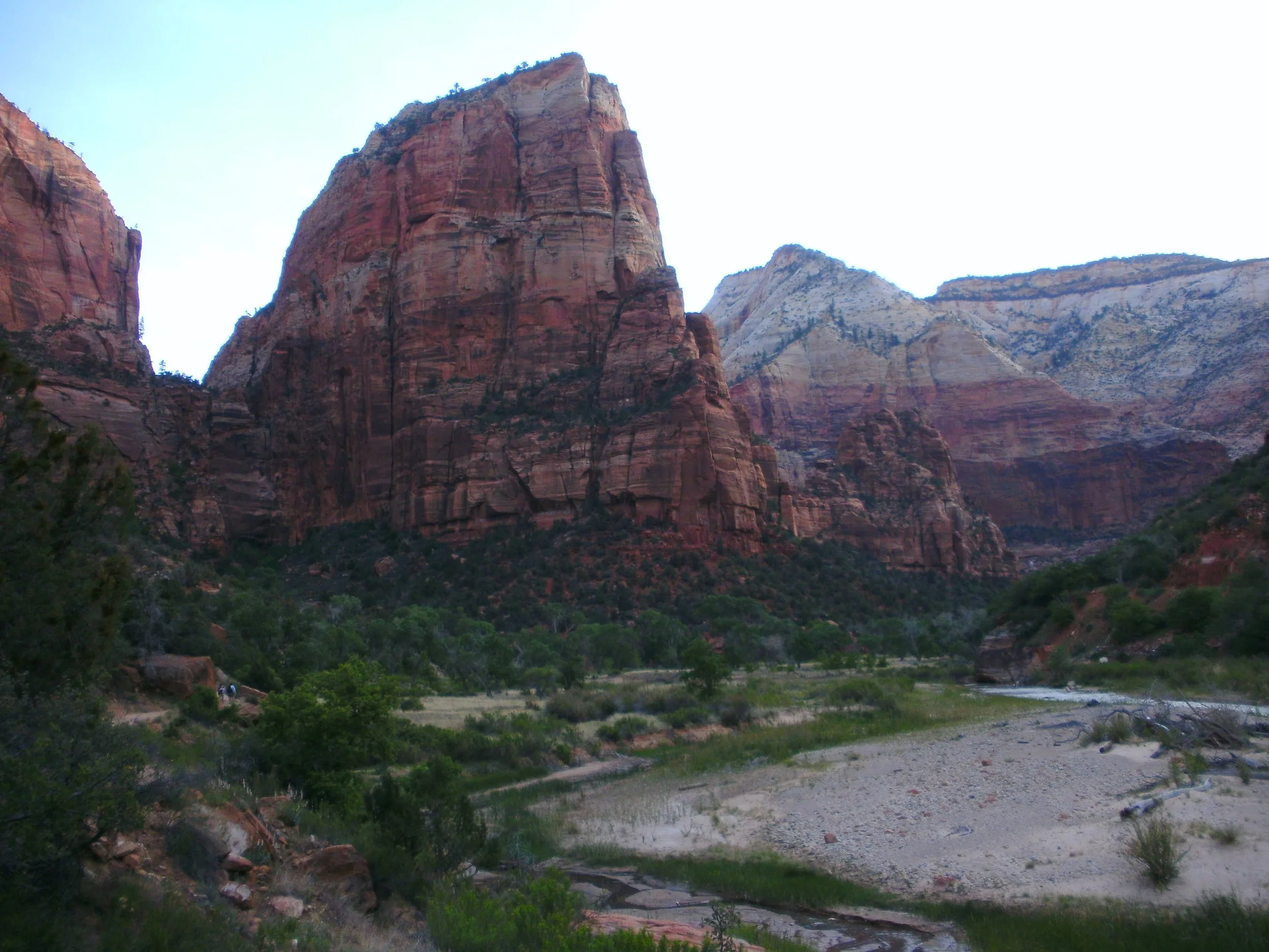
“Angels Landing” copyright BrickBarnBlog2014
Arriving early in the morning, I headed to the Zion National Park visitor's center. (note: parking at the bridge or the few parking spots east of the bridge and boarding the shuttle at the Pa'rus Trail stop, located at the mouth of the main canyon, will save time and avoid several shuttle stops). Several early bird hikers were also on board, and most eyed my rope pack with attached harness and helmet with suspicion. We all exited at the Grotto; everyone had come to climb Angels Landing. I was going a bit further.
BluuGnome does a great job at route description if you want additional detail. However, the route is simple enough on paper. Follow the West Rim Trail to the point it drops into Behunin Canyon. Then, follow the Behunin Canyon route until the first rappel, and climb the ridge line north to the Mount Majestic Plateau. The West Rim Trail is beautiful, Scout Lookout - is stunning, and the wooded section before Behunin Canyon is peaceful. West Rim truly is a hike to remember. I met up with a group of 3 headed to Behunin, and because they were unfamiliar with where to drop into the canyon, we hiked together.

“Making friends on the trail” copyright BrickBarnBlog2014
I had reviewed the TOPO closely, and because my exit strategy through Hook Canyon would put me back onto the West Rim trail later that evening, I stashed a frozen liter of water near the area I expected to reconnect with the path. No sense carrying that much water up and over. Running a little slower than the (much younger) group headed to Behunin, I rounded the final turn to see two of the group hiking up the carved section of rock and the third standing in the bushes, taking a leak. I politely informed him that we would need to pass through the brushes he was peeing on to drop into Behunin canyon. Embarrassed, he was polite enough to use some of his water to wash off; or at least mask, which leaves were wet due to his canteen or his pee.
“Behunin Cayon” copyright BrickBarnBlog2014
Behunin Canyon's approach is downhill, following the drainage. Some bushwhacking, some down climbing, but mostly just following the trail, in and out, up and around. I suspect the group seriously wondered if I was ever going to leave or if I had somehow attached myself to them in an attempt to go through Behunin. After a short break, I said my goodbyes and started up the Slickrock to the ridge. It was a little early to leave the wash, but the face seemed okay. About halfway up, I was starting to wish I had waited until the first rappel, which would have put me directly on the ridge line and more extended, but more accessible hiking. However, this face quickly worked into class 2+ and class 3 in areas.
“Looking back along the ridgeline” copyright BrickBarnBlog2014
At the first saddle, I took another break and ate lunch. The view directly down Behunin Canyon was incredible. The canyon perfectly frames the Mountain of the Sun and East Temple in the "V" of the canyon. The ridge line is chossy, dirty, sandy travel—difficult work. But amazing views. The higher I climbed, the more in awe I became. The canyon description in Bluugnome describes the final 200' section of the scramble as recommending a rope belay; however, I found the section to be a class 2 - 2+ scramble. I guess that's the difference between canyon guys doing scrambling and scrambling guys doing canyons.
The crux is the large pine tree described. A massive root system runs horizontally across the ascent route—a flat slab to the left and a ledge (with exposure) to the right. I eventually just put my hands on the root and pulled myself over (like scaling a chest-high brick fence). The only nasty part about the crux is the ants on the tree. I spent the next ten minutes brushing ants off my arms for the 20 seconds of effort. Another 50 feet or so, and you will arrive at the plateau of Mount Majestic.
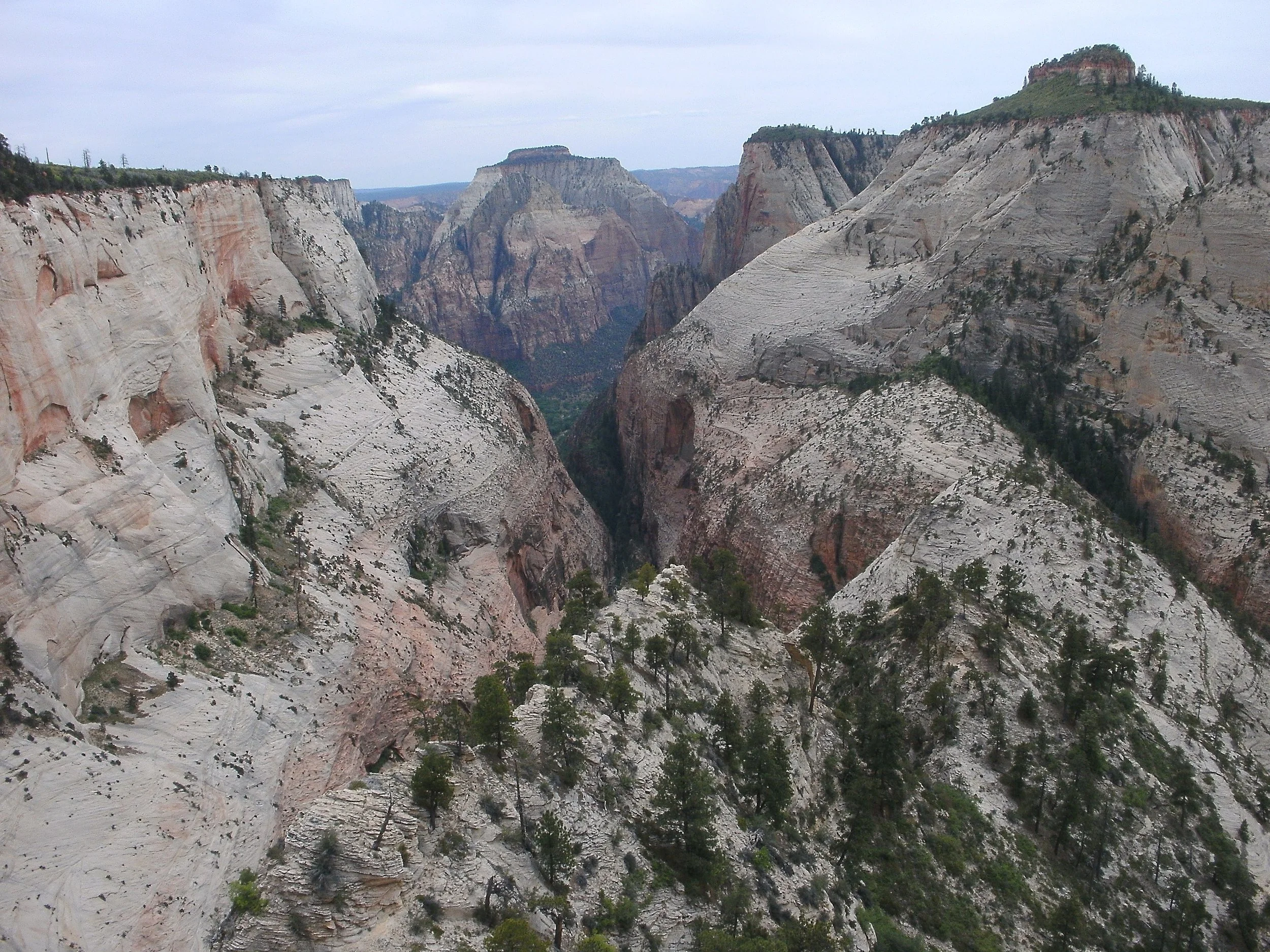
“Mount Majestic” copyright BrickBarnBlog2014
The hiking is accessible around the head of Behunin Canyon, and the views are beautiful, but I would advise staying way back from the edge. Dirt running to sheer cliffs does not a good combination make. I won't go into much more detail about Mount Majestic. I had come to climb the mountain but failed to reach the summit. Mount Majestic has a stone cap which is class 4. There are, in fact, two class 4 areas, and I could not get traction on either section. Frustrating and disappointing. I've mentioned in other posts about my three-strike rule, and I quickly used them up on the various attempts. In my attempts to reach Mount Majestic's summit, I wasted too much time and will be unable to reach the summit of Cathedral Mountain. The mountain is non-ranked but offers stunning views of Walters Wiggles and Angles Landing.
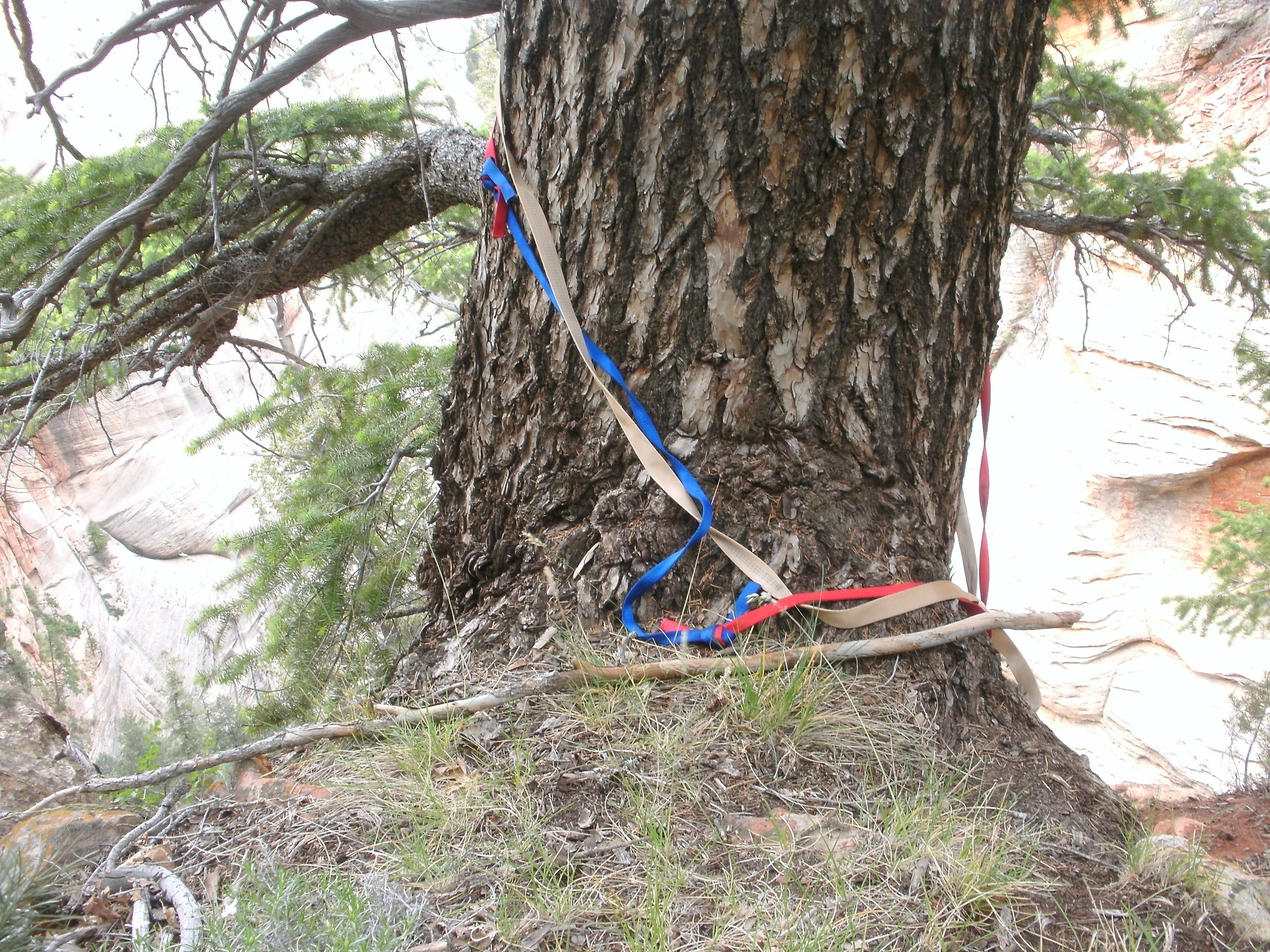
“Primary Anchor” copyright BrickBarnBlog2014
Following the route description for Hook Canyon, I was able to locate the large pine tree and anchor for the first rappel with ease. Someone had recently added a new and second piece of webbing. I checked to ensure everything was in good order and rigged for my rappel. Bluugnome says 120' to the bottom, another site says 150'. I marked off 150' and dropped my rope. Setting up a biner blocker, I tied my 75' pull cord to the short end and rappelled on a single rope. A nice rappel, with plenty of ledge systems in the slanted drop if needing to stop. The final 50' is vertical. The 150' of rope was more than enough, and the pull was clean and easy. The terrain is very steep, making gathering the rope a bit of a hassle, but quickly done. Take care with the down climb, and be prepared to take a few butt plants in the soft dirt and leafy underfoot.
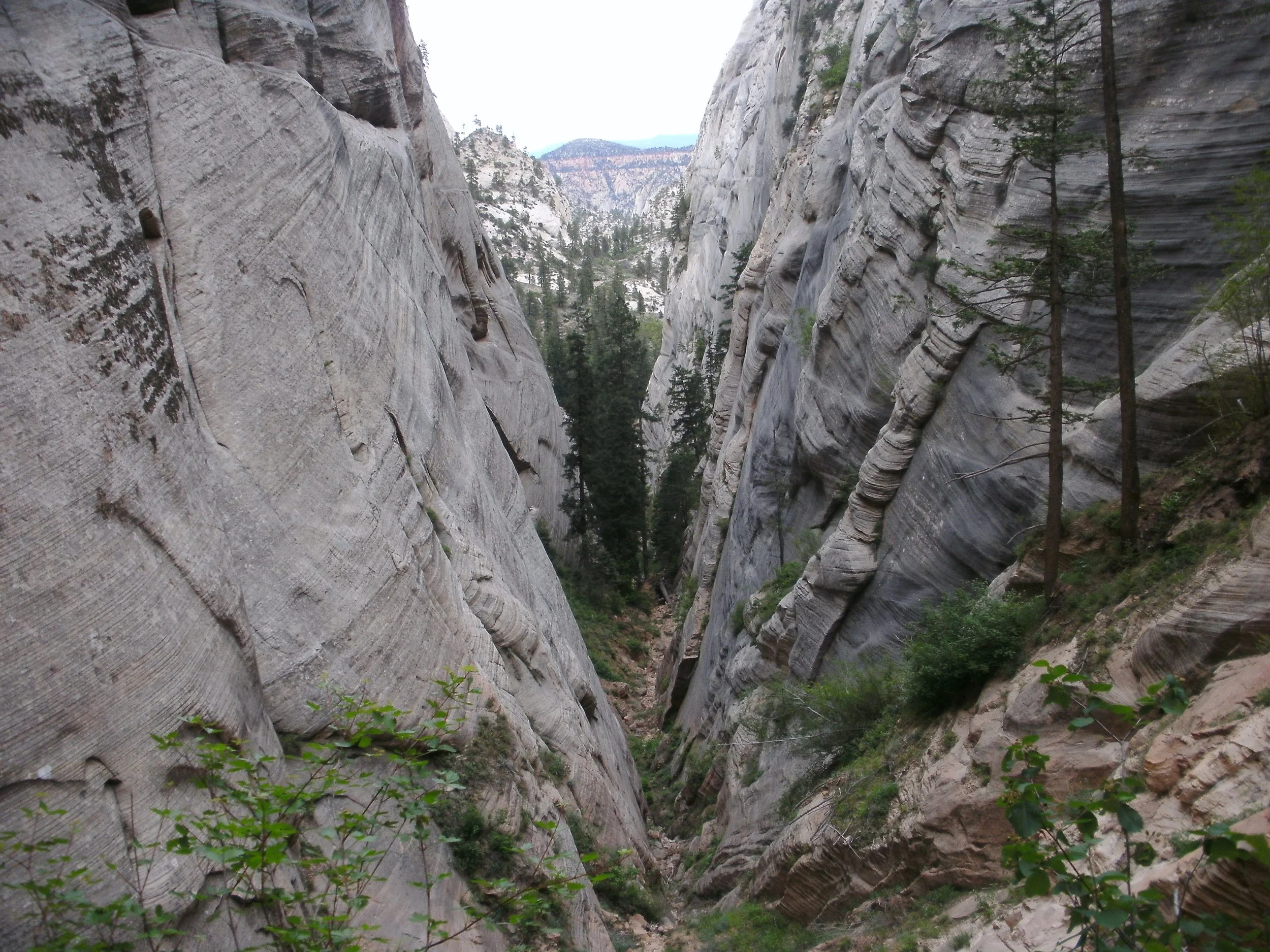
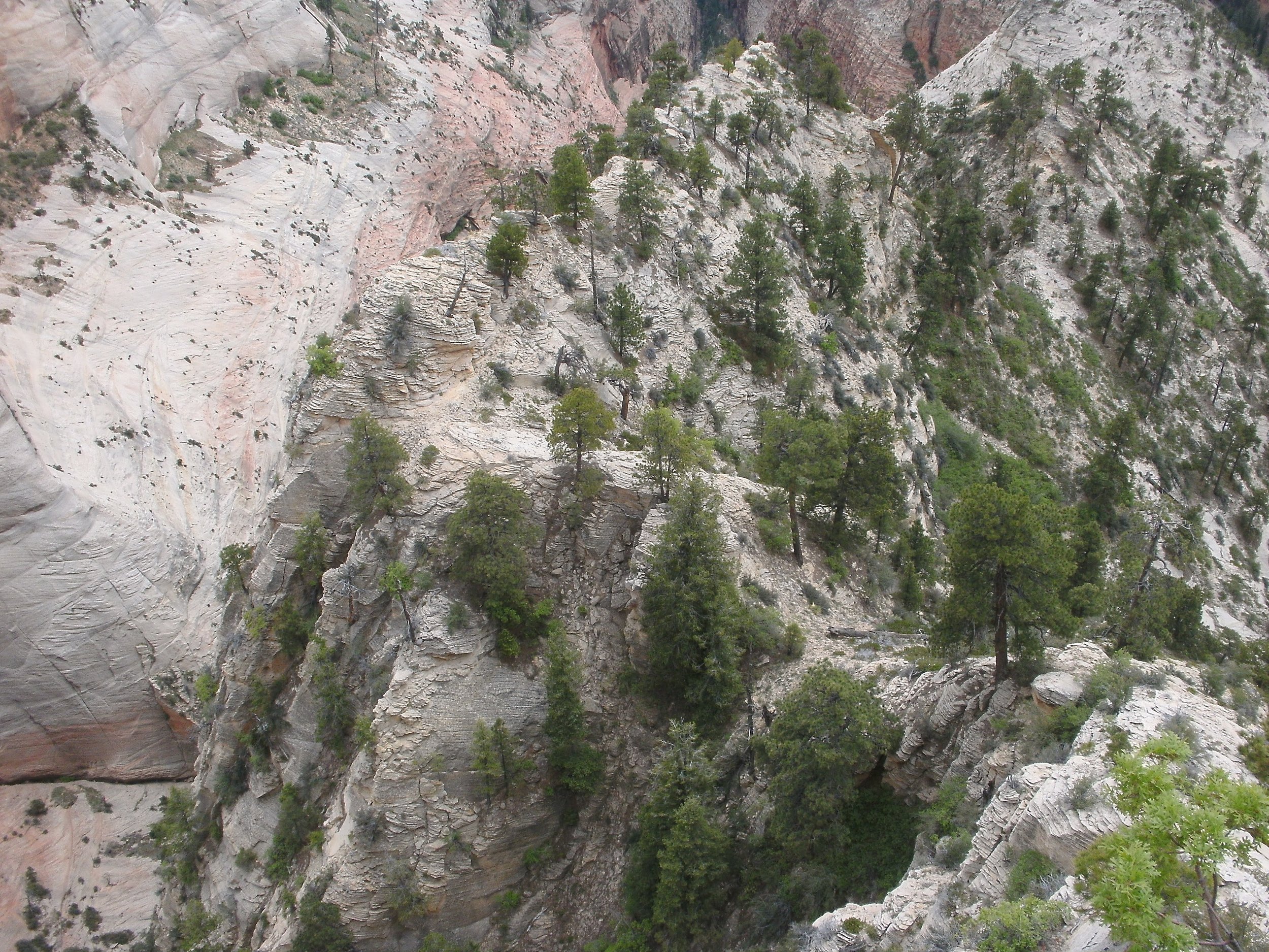
“Hook Canyon” copyright BrickBarnBlog2014
More than a few down climbs of 10' or more, all are easily done in chimney format, feet on one side, back on the other. Most are simply steps down boulders. Not to much route finding, just hiking. This is not a slot canyon. It is very unremarkable in many ways, just beautiful walls of solid sandstone. It is certainly not a canyon that would be worth the effort just "to do". The final rappel I had to rebuild. Plenty of trees dot the hillside which the Bluugnome authors describe for the rappel, no webbing was found and the hillside is dirty and would be a mess of dirt and rocks coming down on top of you from the rope movement. I elected to set up an anchor directly in the wash and rappel / walk down the stream bed. This involves a rugged turn to a small 35' rappel and a more difficult pull, but that worked for me.
I stripped off the harness and helmet to finish the hike out of the canyon. I have been out of water for the last hour, and thankfully the canyon shade had kept me cool and feeling good. But I was looking forward to my frozen bottle of water—nothing like cold water after a hike. As I hiked along a ridge line toward the West Rim trail, I began to worry about my water stash placement. Looking up the waypoint marker on my GPS for the H2O stash, I was sickened to see .65 miles west of my current location. The exact opposite direction I needed to go to return to the trailhead. I had expected to follow the stream bed to the trail, not pick up this ridge. No water for me until I get back to the Grotto.
Stopping to visit with two couples who had just finished Angles Landing, I overheard one say, "yes, there's a little bit of water left," so I decided not to ask if the couple had water to spare. I was feeling good and making good time, but dehydration can be subtle, and I knew I was pushing my luck. We visited a moment, and I headed down the trail. Soon this lagging group of hikers came hurrying past me. I jokingly commented about their rush to climb another peak, and one turned to say, "we will miss the last shuttle if we don't hurry!" Just what I needed. Already 12 hours into the hike and no water for the past two, now I need to hurry?? I did my best to keep up with them as I crossed the bridge, a large group assembled at the Grotto for the final shuttle ride of the night. I quickly filled my water bottle in time to turn around and see the shuttle pulling into the parking area.
It was indeed the final shuttle of the night. I counted my blessings as I sat in the comfort of the shuttle, thinking of all the minor missteps that could have caused me to miss my ride back to the center. The sun was low, casting its final light rays onto the tips of the major canyon peaks. Wow, what a glorious day.