
Anyone who's hiked The Subway has probably watched in awe the growing west triangle face of Rams Peak in the eastern sky. An actual peak (not a plateau), Rams Peak is a testament to the strength of water and wind in this part of the park.

Early morning sun on Rams Peak and Greatheart Mesa
Kolob Terrace is rugged. To venture into the backcountry of Kolob is to test yourself mentally and physically. I arrived at the Wildcat Trailhead parking lot at 7:30 am. The sun was behind the mountains, but the parking lot had already held a dozen vehicles. The Subway is one of the most popular slot canyons in Zion, and a hiker must have a permit to enter. Already a long hike, The Subway, like all slot canyons, can change the challenges you face with each rainstorm. It's been a rainy summer in Zion, so I expect everyone wanted an early start. The parking lot also serves the Hop Valley trail, Northgate Peaks, and Wildcat canyon trail. An advanced slot canyon, located above The Subway, is known as Das Boot.

“The Bowl” part of The Subway trail system.
To make an ascent of Rams Peak, I'll need to cross the Left Fork of North Creek, the creek responsible for the deep slot canyons that exist in this section of the park. What little beta information I could find, the best (and possibly only) place to cross is the Das Boot slot canyon entrance.

Das Boot Slot Canyon
The hike from the Wildcat parking lot along the broad plateau is a beautiful alpine hike. Towering Ponderosa pine trees line the meadows. As you begin to drop into the neighboring canyon, the trail turns to Slickrock scramble. Plenty of cairns and the occasional footprint sign will keep you on the correct path. The path to The Subway is a well-traveled trail seeing hundreds of visitors each month. Please do Not follow my approach. I traveled too far on The Subway trail and was forced to backtrack through scrub oak and other forms of a thick brush to arrive at the entry. There is, however, a faint trail and beautiful views into the Das Boot section.

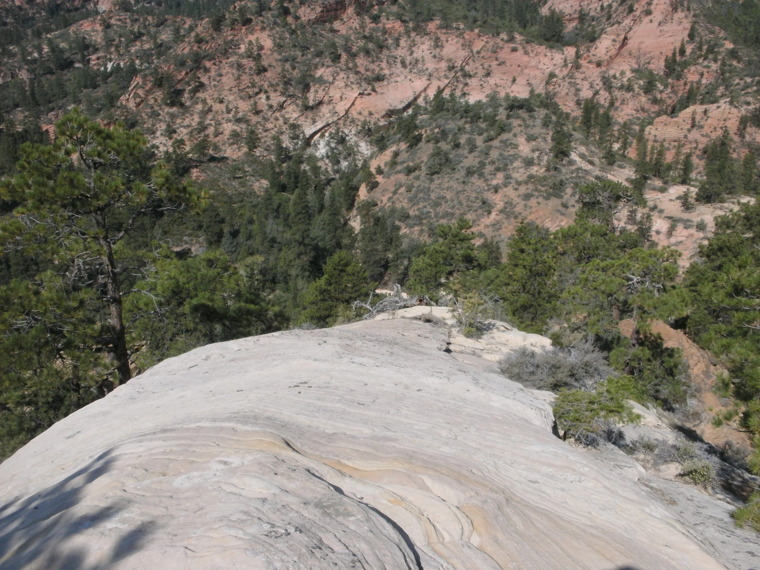
Looking down into Das Boot Slot Canyon
Arriving at the entry to Das Boot, I had dropped 1,285' in elevation. Squeezing through a small chimney crack out of Das Boot, be prepared for a 1,425' foot ascent. No trail exists, not even a faint one. The beta I found indicated a climb up the deep, tree-filled slash on the western face was the best approach. After studying the TOPO, I believed that taking the ridgeline wash just to the south would lead to a smaller saddle and approach the ridgeline connecting Rams Peak with Greatheart Mesa on the east. The approach was a gamble, but I knew the prior group whose beta I was using proceeded along this ridgeline to make a summit of Greatheart Mesa on the same day.
Looking down the slickrock ridgeline
I found myself standing on the small western saddle, and my heart dropped as I looked at the high valley separating my ridge from the main ridgeline leading to the mesa. Around a bend would be the only way to know if an approach from this angle was possible. I dropped off the eastern side and rounded the bend. A nice wash with extensive, vast shelf systems made the scramble to a small saddle possible to my delight. I proceeded to this point. Dropping my climbing rope and excess water, I decided the scramble to the summit of Rams Peak was going to be class 2. I'd pick the climbing rope and water up on my way to Greatheart Mesa if time permitted a possible ascent. I was already running slow.

Wash with extensive shelf system to ridgeline connecting Rams Peak with Greatheart Mesa
Following the chossy ridgeline, beautiful views await on both sides. Looking south, the Guardian Angels keep watch over Zion National Park. What a breathtaking sight. As I continued to hike up the ridge, northern views contain the plateau host to the West Rim Trail. Stunning. The Hourglass, Greatheart Mesa all beautiful. Near the summit, more bushwacking and chossy scramble. I break through the last bit of brush and find a small outcropping of rock and a summit cairn. No summit registration exists. I had remembered to bring a jar, with paper and pencil to mark the event.

Rams Peak ridgline view of South Guardian Angel
Walking west a few feet is a sharp drop off as the peak gives way to the sheer depth of the western face. The views are spectacular. I took plenty of pictures.

North Guardian Angel (left) Northgate Peaks East & West (middle) Pine Valley Peak (right)
Arriving once again at the saddle, I am impressed that the group made double ascents. I pick up my gear; the second ascent is not going to happen for me this trip. Climbing back out the western side of Das Boot, I follow the trail as best I can back to The Subway trail. Again don't follow my GPS path. I lost the course and, not having a description, doubled back off a ridgeline and had to backtrack to the Slickrock bowl to pick up the trail. Das Boot trail follows the ridgeline to the top of the bowl. I was taking at least an hour off my round-a-bout scramble.

View of Ridgeline between Rams Peak and Greatheart Mesa
Reaching my car just before dark, I wasn't the only one still here. One other vehicle held its place. The driver is exploring this rugged wilderness and hopefully enjoying it as much as I have this day.

Rams Peak