
I first climbed Lost Peak in February of 2012. It was a wonderful winter ascent, hiking along the ridgeline, hugging close to the edge where the western sun had melted enough of the snow to create a pathway of dry slickrock. When I reached the summit, there was barely a handful of stones to mark the summit cairn. Writing of my experience on Everytrail.com I had often wondered at the affect my report would have on this fragile landscape when my report had been downloaded hundreds of times. I decided a return visit would be warranted. Other trip report writers have decided not to republish their works because of the increased usage their reports created. I had always been of the opinion that more information (beta) for backcountry hikers, backbackers, canyoneers and scramblers was worth the impact. Most would venture there anyway, making it safer seemed to be the right decision. I was surprised when one of the authors decided to republish a previously out of print work with an expanded range of summits in the Zion and surrounding area. I, of course, purchased the book. This trip served two purposes. First: Review the summit of Lost Peak to determine impact to area. Second: Complete 2 minor peaks located in the area, that I had skipped earlier as non-ranked peaks, but were now listed in the book.
This truly is one of my favorite East Zion routes. I've looped in and out of this area a dozen times over the years. Dropping into Pine Creek just before the small tunnel (past the long 1.1 mile tunnel) first hike down a small tributary until connecting with the main creek bed and turn left. Follow the wide Pine Creek bed (extremely rocky) until a lone pine tree towers in front of a slot canyon. I was surprised to find a massive log, jammed against the leading edge of the rock. This tree log is easily 4 feet wide and was not here on any of the previous hikes up this section of Pine Creek. If you ever doubt the power of a flash flood, this will bring it to light.
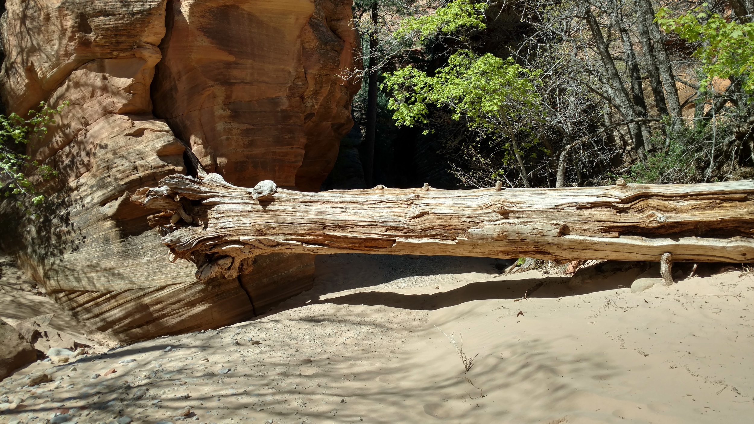
Massive tree log, new since last hike.
Just past this tree, turn up the very short tributary and climb up onto the slick rock. This section is very steep, so pick your way with care. Make sure to "see" your route before moving, using the series of ledge systems to reach the top. The top levels out to a gentle grade and a long hike up a fabulous slick rock slab. The entire slab is probably 900 feet in length and is one of my favorite in the park.

TOPO map showing entire route.
At the top of the slab, continue to follow the ridgeline to the base of Lost Peak. The route is straight up the northern ridge. The first obstacle is a chest high wall which is a simple matter to overcome. The next wall is considerably higher and more technical. During my winter ascent, I went straight up the wall, keeping to the weakness on the right. A large bush and ample hand holds makes the climb class 4. On this visit however, I noticed, one can sidestep the wall by moving to the right out onto some slickrock. This option was covered in snow on my first ascent. Good feet positions are available, but it is exposed and chossy. I took the slab route up this time, but decided to use the wall on descent. Like all class 4 moves, having some kind of hand line or rappel setup works best. Thankfully a large tree exists just above the wall and 70' feet of rope is all that is required. I used my handy 6mm rope to descend the wall. The summit views are stunning, and I didn't notice any unusual damage to the area, at least no more than normal wear and tear in the backcountry of Zion. Which, by the way, is seeing more and more traffic as people are no longer content to just follow a maintained trail through the park. Some people call it exploration, I have a hard time calling it that as hundreds if not thousands of people have visited the area. I would call it "off the beaten path". Leaving the term "Exploration" for places never before visited by man.

Lost Peak summit view west. First peak in view is Lost Teton, my next objective.
I drop back down to the sand and cactus valley and work my way toward Lost Teton. This is one of the minor peaks mentioned in the book. I reach the summit with little effort and record my ascent. Looking back east toward Lost Peak is truly an impressive sight. Hiking up the slickrock slab it is hard to notice what a large and rugged sandstone peak Lost Peak is. This side view however puts it into perspective.

Lost Teton summit view east toward Lost Peak.
Dropping back to the sandy valley again, I round the corner behind Lost Peak only to discover my mistake in not reviewing the TOPO map a little more thoroughly. It is going to be an uphill slog through sand as I cross behind the Triplets and Fin peaks to reach the peak known as Point of Compassion. Had I been paying more attention, I would have reversed my loop and started here instead, giving myself a downhill route.
The Point of Compassion is an unassuming peak that is hard to notice on an approach from the west. It rises to a rocky outcropping behind Nippletop. However, the peak would be a serious climb if approaching from the east as the landscape gives way to a rugged, slickrock decline into separation canyon. I spent some time on the point eating lunch and retrieving my hat which blew off the steep side to a rocky ledge below.
Looping back between the Fin and the Triplets I work my way back toward Pine Creek. It's been a full day, and I have covered a lot of ground, but being able to summit 3 very nice peaks in one afternoon of backcountry bliss is what Zion National Park is all about.