
Another storm is heading our direction. This time the series is promising snow and plunging temperatures into the upper teens. With its appearance expected Friday, I decided to take Thursday off and head west. Cedar City, Utah, isn't far from the Nevada border, and it's surprising how little time I spend in the western desert. Rugged hills surround the tiny settlements of Modena and Panaca, nearly reaching the 8,000-foot summit range.
Panaca, Nevada, is a beautiful town as I turn on North 5th Street and Panaca Spring Road. An ATV staging area is adjacent to Panaca Springs, and a sole motorhome greets me as I pull under the towering cottonwood tree. Fall is here, and colorful leaves litter the ground, with some still clinging to the high limbs.

ATV Trail view of UNP 5530, Lincoln County, Condor Canyon - NV quad. NV Peak Rank: 5667, NV Prominence Rank 6249.
Mr. motorhome walks over to say hello and informs me that most of Condor Canyon has recently been purchased by a local rancher (EDIT: Condor Canyon has been on private property since the early 1970s. The family that owns the canyon also owns the mill site located near Panaca at the end of Condor Canyon. Please respect and obey all No Trespassing signs in the area.) who had built a gate across the road before reaching the waterfall along Meadow Valley Wash. That's unfortunate as I was looking forward to making the drive. The wash is one of the highlights mentioned in RiderPlanet USA. If I have time, I will probably ride up the canyon as far as I can, a cave also exists along the route, and I'd like to see where the gate resides.

Summit view into Condor Canyon
I wave goodbye as I pull out of the staging area on my quad. Like most sites, Rider Planet doesn't highlight the trails, only the staging areas, and other exciting points. I'm on my own to figure out the trail system and arrive close enough to UNP 5530 to find where the existing GPS tracks start. After a few stops and checks, I turn east into a large wash. The path is well worn, and as it turns up a ridgeline, the road appears to be of recent construction. Many communities have recreational areas where locals have gone for years to ride. I appreciate those towns willing to put in some time and effort to improve the sites for travelers who might spend a dollar or two on their way through.

ATV Trails and Black Hill in distance
Unnamed peak 5530 rises to my left as I find the connecting trail and trailhead. Multiple layered hills create a roundabout way of reaching the summit, which I arrive in short order. Condor Ravine is splendid as green grass follows water flow, and Cottonwood trees hold onto bright yellow leaves.

ATV trails and Hoodoos
I continue to ride the Panaca trails in search of a way to reach the summit of Black Hill. A road is visible, but I can't seem to locate the beginning. I finally give up and wander the trails through washes and sandy pockets.

Cathedral Gorge Picnic Area
Back at the truck, I load the quad and head for Cathedral Gorge State Park. Located only a mile from Panaca, Cathedral Gorge is one of Nevada's unique wonders, becoming one of the first State Parks in 1935. (Park brochure) The picnic facilities were constructed by the Civilian Conservation Corps (CCC) in the 1930s, and I find an empty table to eat my lunch. The old cistern and stone restroom facilities are visible but no longer in use, and people roam the picnic area and the short slot canyons carved into the hillside.

Narrow Slot Canyons
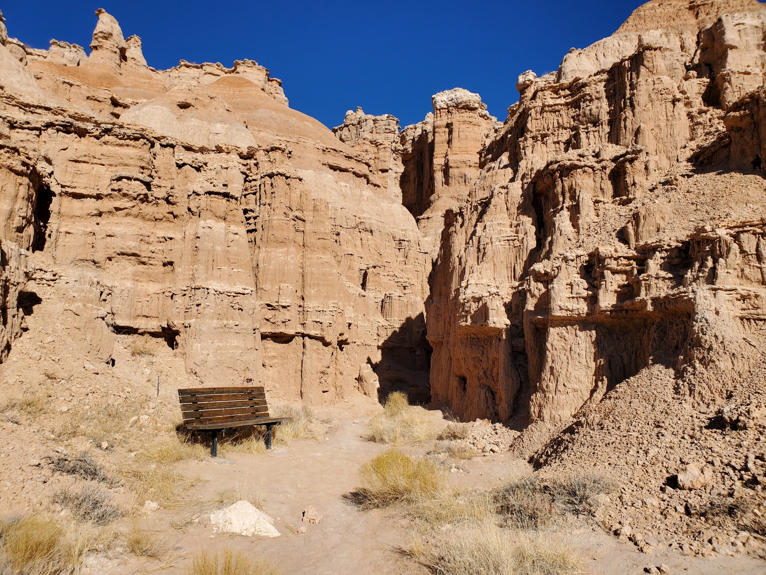
Finishing my lunch, I take a look into the slot canyons. I'm not sure what I was expecting, but towering walls of dried mud 30-50 feet tall wasn't one of them. It is stunning, and I jocky to get a good picture that will show even a resemblance of the fantastic place.

Juniper Draw Loop
Juniper Draw Loop trail borders the picnic area as I leave for the hike. A 3-mile loop, following the central gorge north, near the eastern face, returning along the center of the wash following the creek bed. The trail is impressive and provides a great deal of solitude as I hike the course alone. Benches are provided in strategic locations, and I take advantage of drinking some water and enjoying the view. It is mid-afternoon, and during the summer months, the heat would make the path unbearable, but in November, even direct sunlight is pleasant, and I enjoy the walk.
Juniper Draw Trail
Caltopo map can be found here.