
I roll out of bed early this morning, not because I'm trying to beat the heat, but because it's my bed. I didn't go camping this weekend, so I have a long drive ahead of me. After a brutal cold snap last week, where the temperatures dropped to 20 degrees, it has warmed up again, and I'm excited to explore a new area.
Logandale Nevada is an extended narrow farming community that sprang up along the Muddy River basin. Linda and I have visited Logandale a few times for the annual Logandale Pomogranite festival, and today I'm heading back to explore the ATV trail system and look for possible camping sites for this winter. During the winter months, I rarely camp due to ski season, cold weather, and short daylight hours. With COVID-19 making a comeback and several European Ski Resorts already announcing they will close for the winter, I want to explore alternative destinations if our local resorts are forced to close.

Logandale ATV Trail system
Logandale is 1,365 feet above sea level, and my ears pop as I drive south from Cedar City (elevation 5,800) south on I-15. The Logandale exit is a long extended ramp near a steep hill's conclusion, as I coast to a stop. I've climbed a few peaks in this area, and I love the rugged beauty of the desert. The summer daytime temperatures can be fatal, but the low elevation makes it a popular winter playground.
Nevada state road 169 twists and turns into the river basin; the Logandale ATV trail access signs are well placed, and I arrive at the first staging area in time to be the second vehicle in the lot. An extensive tour guide rig is unloading a half-dozen modified dune buggies when I arrive. Parking at the opposite end, I unload the quad and pack my gear.
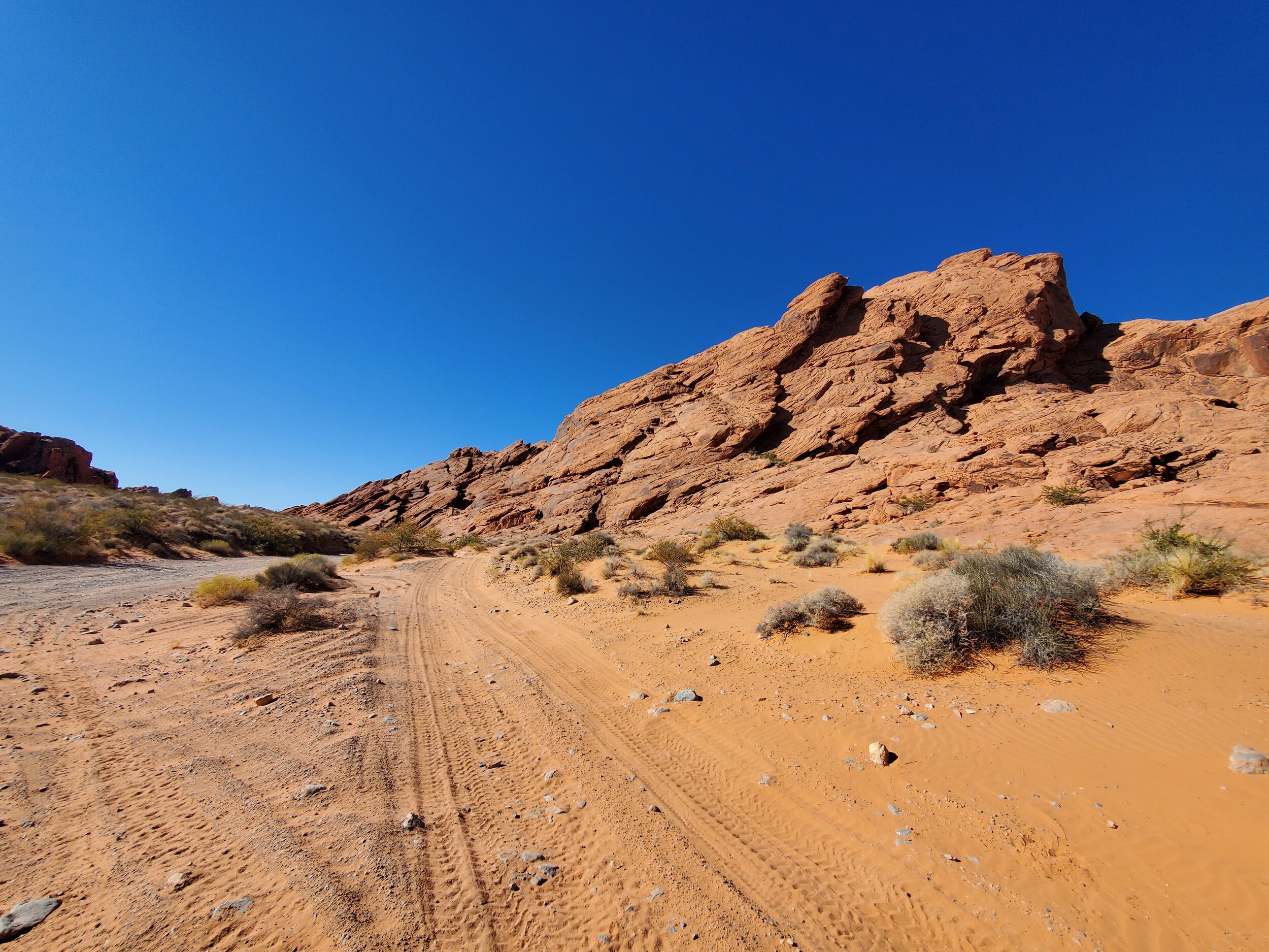
Logandale ATV Trail system
I don't have a plan today; I want to ride a few of the trails, find possible camping sites, and summit a peak or two that I have identified in the area if I can. I start the ATV and continue down the well-maintained gravel road. I reach the second staging area, where several camping trailers are parked, a dozen trailers unloaded, and sit empty in the parking lot. With my GPS, I turn west down a bumpy trail. Upon reaching the ridgeline, I marvel at this beautiful country; it is also apparent, I'm on a more advanced track than I should be as the path drops down a steep and rugged ravine. A more gentle trail follows the ridgeline, and I complete a short loop back to the staging area. I follow the road again to the dry river bed below and find more camping trailers; a lot more. I capture a screenshot for GPS coordinates and continue following the sandy trail south.

Small dunes are the best!
Rolling small dunes provide the most fun as I ride to the end of the trail. I'm surprised that I have yet to pass anyone else on these trails based solely on the number of vehicles I've seen. But I'm cautious as I enter the narrow twisting (single track) turns, keeping an eye out for dust or a glimpse of a moving vehicle. My GPS tells me I'm near the trail I identified as leading to the peak N 104 E Benchmark. I turn and follow the rugged path out of the soft sand, across Slickrock, and onto a high plateau.

N 104 E Benchmark, NV Rank 6963, NV Prominence Rank 4184, Clark County, Weiser Ridge - NV
I see peak N 104 E Benchmark in the distance, and a track leads directly to the summit. I follow the course but stop short as the path becomes too steep for me to be comfortable with following. I hike the remaining way to the summit. Peak N 104 E Benchmark is almost 1,000 feet above the sandy trail bottom below. The view is stunning, as the entire length of the red rock ridgelines opens up to view. The Valley of Fire state park is direct to the south, and I make my way down the mountainside and back to my waiting quad. After checking a few sidetracks, I return to my truck and drive to Valley of Fire state park.

Summit view south
The park is busy; it is a beautiful day and only an hour's drive from Las Vegas, which is evident by the number of vehicles that line every trailhead parking lot. I drive through; the campground is full, the desert camping sites are too, the public lands look like small cities made up of trailers and motorhomes. I'm discouraged. I'll need to re-think my winter strategy or find even more remote areas to visit this winter.