
It's going to be a windy day here in Cedar City today. My free day, my hiking day. I pull up the wind map on my Weather Bug application to see if I can find someplace close with little to no wind. Thankfully, almost anything south and west of St. George is going to enjoy beautiful sunny days with little to no wind.
After consulting my quad maps, I find a solitary peak unclimbed in the the Virgin River gorge. It's the final peak in the Mountain Sheep Springs - AZ quad and I know why it is the final peak, there is a river crossing and a fairly long approach to reach the peak.
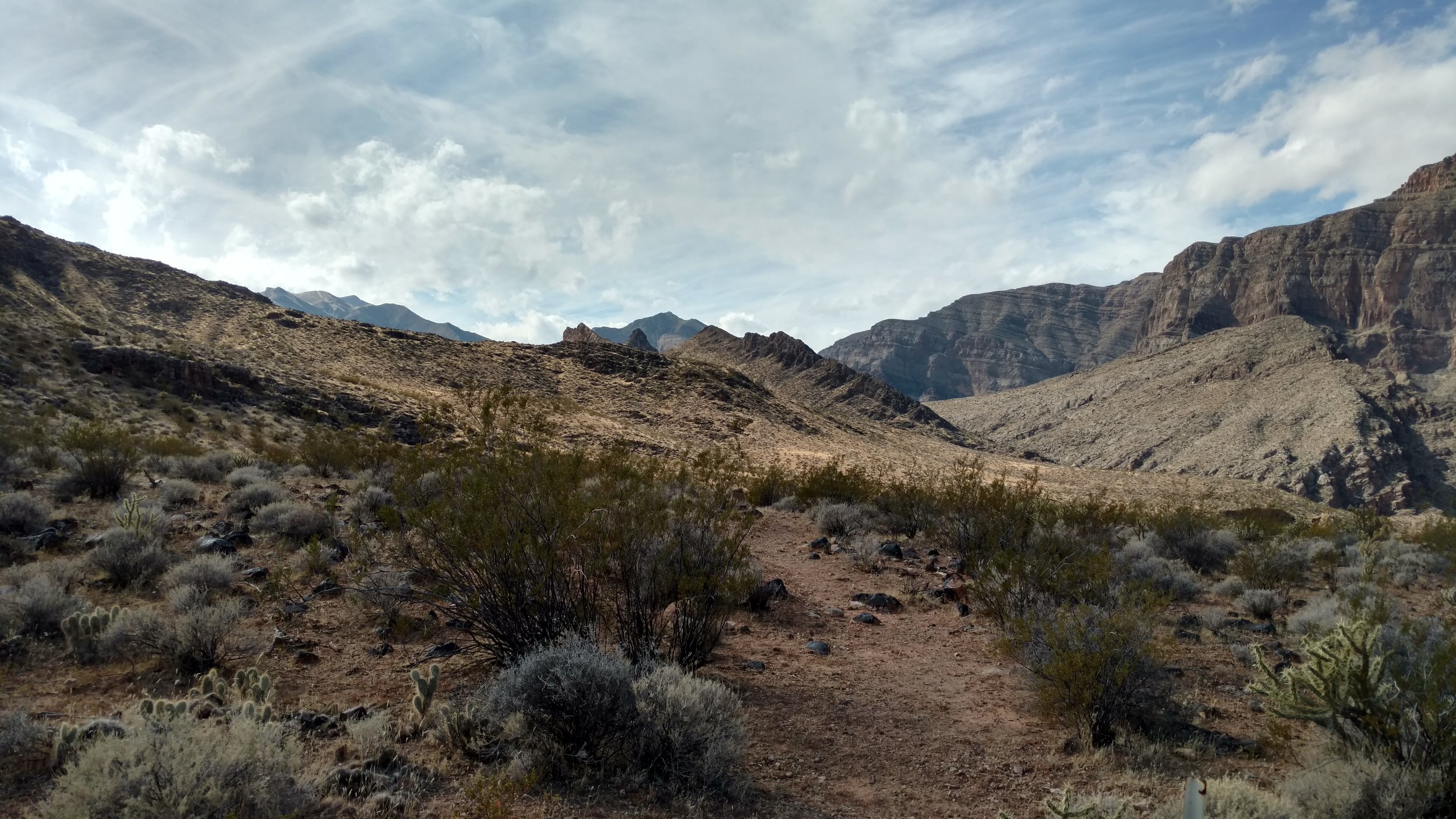
Trail view south toward un-named peak 3022
The peak itself isn't big, probably 1500 feet or so, but the hike itself will probably be 3-4 hours, couple hour drive to reach and a couple hour return trip. Sounds like a long beautiful day.
I pack my bag, make the necessary map and location notations and email them to Linda. And I head toward the gorge. The gorge is a spectacularly rugged series of peaks and crags. Thankfully there is a wide spot in the gorge and is the home to Cedar Pocket and the Virgin River Canyon Campground. The beautify of Cedar Pocket is the north and south bound entrance ramps to the freeway. If not it can be a long drive to Beaver Dam in order to turn around. The Sullivan's Canyon Trailhead is located at the lower "day use" section of the campground.
When I arrive the gate to the lower section is closed. I probably should have stopped at the host campsite and asked if they would open the gate or at least what time it would be open, but I simply parked the Fj near the gate and walked the quarter mile to the trailhead. I wore my old Nikes complete with missing toe and worn heals and felt every rock on the stream bed between the trailhead and the river crossing. The current was okay, the water about knee deep and I was glad I brought my hiking pole to help with balance.

Carin along the trail
Hiking up the sandy trail, before changing shoes was a mistake, buy the time I found a place to sit down and change, my feet (no socks) were mud caked with sand. I rubbed them with dry sand until they were dry before putting on my socks and hiking shoes.
The Sullivan Canyon Trail is nice, it follows the Virgin River and is sometimes difficult to follow, but I was surprised by the number of footprints I see. At about the one mile mark the trail climbs out of the riverbed and hikes along the foot hills. Nice large cairns mark the trail and the path is easy to follow. A fence and hikers gate are on route. I'm not aware of any private land in the area, but their might be grazing rights a long the foothills.
The trail ends with a well beaten path from the hillside down into the canyon. Sullivan's Canyon is itself very impressive and I pick up some beautiful red and black rocks for Linda to consider using in her Jewelry business.
The scramble section of the hike begins and there is no beta on this peak. It's been climbed before, but no one left a trail or GPS log. Two canyons drop off from the peak, one a short way up the canyon and one I need to backtrack a little before I can enter. I decide to backtrack and enter the long canyon. I need to pay a little closer attention to the altitude marks on my TOPO maps because in hindsight this is absolutely the best canyon to enter and it is a nice leisurely hike up the gravel wash. The wash further up would have been a massive ascent then a drop into a small valley on the other side.

Looking back over the scramble long wash
My wash only had one crux, a short climb of about 8 feet. The climb wasn't difficult with plenty of hand holds and places to put my feet. Hanging on the back side of the climb was a beautiful green plant. Leaning into the plant to make my climb, I felt a tug and parts of the plan breaking free. At the top of the climb I realized that I was dragging half the plant. The leaves were filled with small stickers that plastered to everything they touched to the point I had to take off my shirt. I played around with trying to pry off the leaves, but ended up with stickers in my fingers, so I put the shirt in the vent zipper of my pack and proceeded with just my t-shirt and windbreaker.
This is stunning country. The hike up the wash ended near a high saddle splitting the water flow north and south. A dark rocky outcropping which can be seen from the campground is a rocky ridgeline containing a beautiful arch. I took several pictures and want to check the arch website to see if they have a record of it. It can't be seen from the freeway and I'm sure not that many people have hiked to the summit.

Window Arch
I turn west before reaching the saddle and scramble up the side to the western ridgeline. I’m curious about the freeway and hiking ridgelines are usually easier. The view down into the Virgin River gorge to I-15 is amazing. I had forgotten how steep the drop off is and I feel as if I'm directly overhead. I take a few minutes and decide to eat lunch.
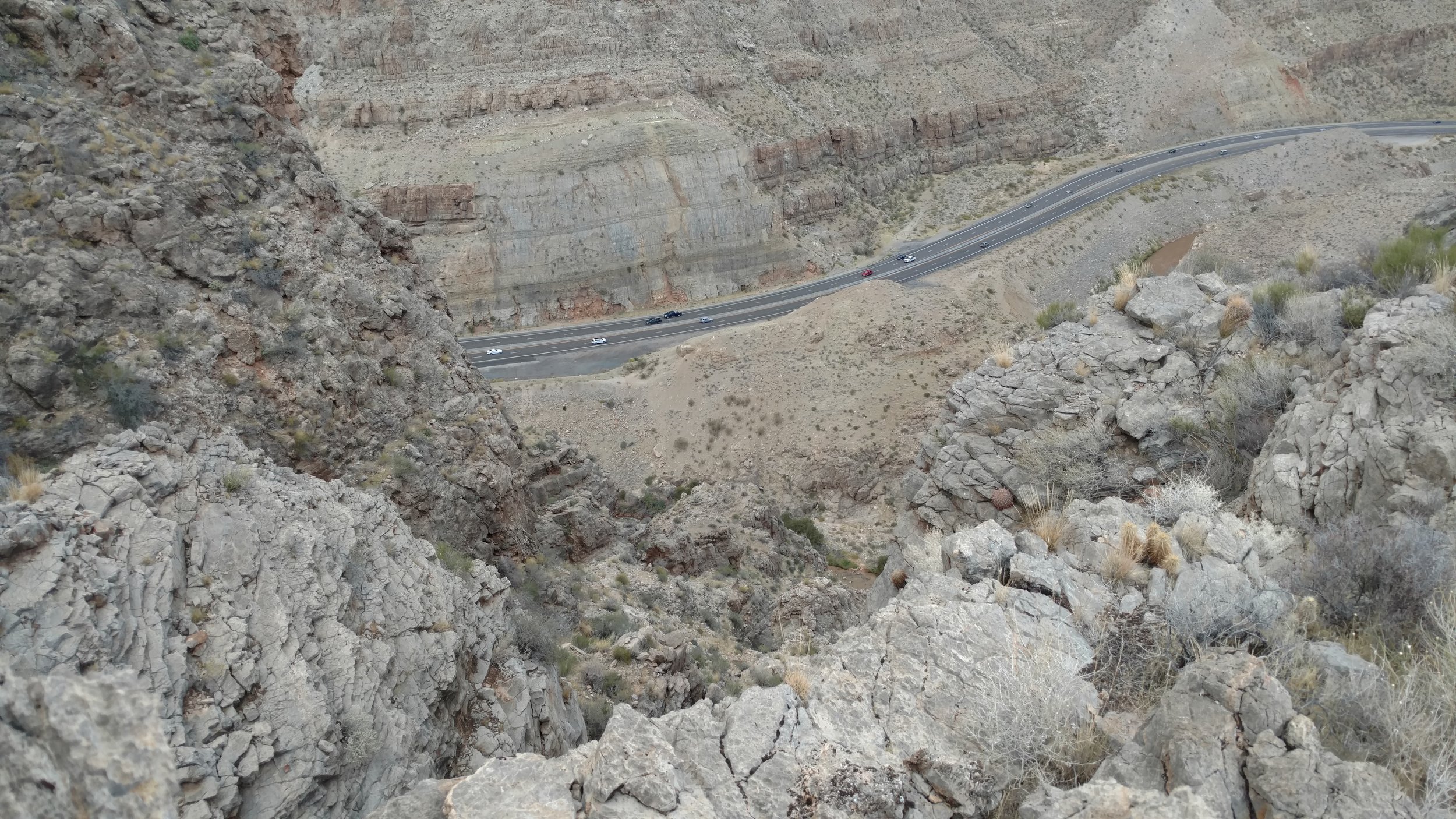
Ridgeline view down to I-15
The ridgeline is a nice line of travel and I make my way across sever false summits to reach the main summit. There is a second summit at the end of the range before dropping off sharply to another canyon, but I don't hike to the end. I've been out longer that I expected, it's getting cold in just my t-shirt and I break a sweat in my windbreaker.

Summit view south, Shadow Mountain and I-15
I enjoy the summit, eat my final snack and marvel at the rugged landscape before me. Shadow Mountain is directly to the south and the entire mountain range looks as if it was picked up and tilted at a 45 degree angle. Many monstrous peaks reside south of my position, including peak 6180. The prominence rise is only 302', but the summit is 6,180 and Sullivan's Canyon floor is probably 2,000 feet, so that tells me that if I decide to venture onto the mountain side, I'd better be prepared for 4 - 6 thousand vertical feet. I'd better save that for another time I decide.