
By far, most peaks are unnamed. We don't think about it much because most of the impressive peaks and famous peaks are named. Mount Everest, K2, Kilimanjaro, to name a few. Move closer to home and peaks were named, not by famous explores, but by pioneers or Native Americans. If you look on a TOPO map it's not uncommon to see an "X" or other summit marker with a simple number by it. The number represents the elevation at the highest point, therefore an unnamed peak with an elevation of 6180 becomes unnamed peak 6180. This poses a problem when there are thousands of potential peaks named 6180 and so keeping track using GPS waypoints and Lat + Long markers helps clear things up.
A peak bagger, climber, turned outdoor book writer that I have followed over the years; Courtney Purcell is gifted in his ability to name peaks. In his book "Zion Summits" Purcell has named each of the unnamed peaks he has climbed by choosing something of personal experience while climbing the peak, or a feeling, the attitude for the day or after someone close to him who is experiencing hardship. I say "gifted" because even though none of us were on the hike or feeling like he felt, the names make sense and they are slowly making their way onto websites and other locations. I've tried to do something similar, but mine usually come back as "stupid hang nail" or "what was I thinking" or the ever famous "I'm to old for this shit" peak.
Thankfully this morning is different. Linda and I arrived yesterday with a group of Linda's friends from her rock club. Once a month they go Rock Hounding and it's fun when they choose a place that overlaps with some mountain peaks or slot canyons. Today I hit the jackpot as Goblin Valley State Park in the San Rafael Swell is well known for its array of slot canyons and a quick review of websites indicate a rich environment for bagging some peaks.
Goblin Valley State Park contains a small campground, but the park itself is small and surrounded by BLM ground which allows open camping. Exit I-70 onto Utah State Route 24 towards Hanksville. Follow the sign to Goblin Valley State Park and turn onto Temple Mountain Rd. At a junction (of sorts with information board) Left is the Goblin Valley Road and the park. Straight is a paved road and open camping. Just over the rise is the group camping and staging area for ATV activity. If you continue west on Temple Mountain Road, literally hundreds of camping sites are dotted among the Juniper trees and river beds. I highly recommend being very choosy in picking a campsite beyond the pavement. The dust cloud that billows up behind even a slow moving vehicle is horrible and to park close to the road is an invitation to camping in a perpetual dust storm.
Linda and I did a partial scramble of unnamed peak 6100 last night after setting up camp, and it became obvious the San Rafael Swell requires a careful study of TOPO and route finding skills due to the many cliffs and canyons that cut the swell up into the various peaks. From our sub-summit last night I spotted a former ATV track cutting along the hill side toward peak 6180 and that is my direction of travel this morning.

Linda and her group left early, I didn't linger at the camp as the blue bird sky and cool temperatures begged for starting the hike. This is the desert after all and temperatures can easily rise to triple digits even if the day starts out cool. I make my way up the old ATV trail along a slick rock road.

Old ATV trail
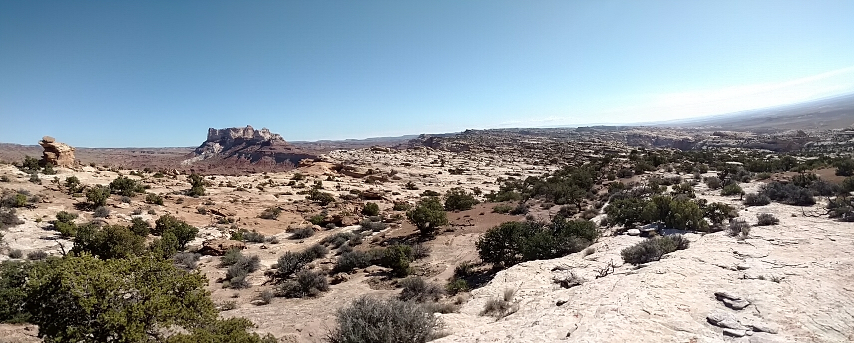
The elevation quickly rises and with it the view. Reaching the point I am greeted with a stunning view of Temple Mountain.

Temple Mountain
It is a paradox of names that Uranium was mined on Temple Mountain near Goblin Valley and used in the Manhattan Project. As I set my sights on the summit I recognize the hard climbing is over, but the route finding has just begun. The modest rise to the summit is laced with a few canyons, so I begin to move uphill and along the first canyon looking for a way to descend and up the other side. A few well placed cairns and a constant review of what's behind me (turn around and study the landscape so it will be familiar on the return trip) I make my way up the center (brown) rib between two canyons. Other options exist, but the center backbone, turned out to be an easy stroll alternating between dirt and rock. The gentle rise guides me directly toward the summit area.
A look back along the route
Arriving at the summit area, I use GPS to pin point the summit location. Not unusual in these types of peaks, the exact high point is different than the GPS coordinates for the summit. I wander around to 3 different spots, each looking higher than the next and finally spot the summit cairn.

Summit cairn for unnamed peak 6180
I pick a spot near the cairn and eat my morning snack. The view of Temple Mountain and the surrounding area is stunning. A few hundred feet to my left (west) is the shear drop off cliff of the Swell. The sudden drop creates a beautiful view of the horizon in every direction.

Summit view north
I spend some time here on the summit and enjoy the view. The absolute stillness. I'm far enough away from the roads that even the road noise is eliminated. Little to no ambient noise that I can discern is making it's way up the canyon from the campground and it is wonderful to my ears.
Making my way down the mountain I decide to stop at the Temple Mountain Wash Pictograph Panel located just below the summit that Linda and I stood on last night.

Subpeak for 6100 and The Temple Mountain Wash Pictograph Panel
The panel "is significant because it contains some of the largest prehistoric painted figures in Utah." I'm no expert, but these are some of the sharpest contrast panels I've seen. A fence prevents me from getting to close, but I'm happy to sit in the shade of the information board and stare at the panel for awhile. It is getting warm and I'm grateful for the shade and the view.

Temple Mountain Pictograph Panel
As I stare at the panel, I can't help but be amused. It's probably a picture of early campers complete with dog, cook stove and someone asking why are we having snake again tonight? The information board says different, but that's what happens when we live in the age of meme's and nothing is spared from a "caption this". I make it back to camp around lunch time and I'm excited for the first hike of the day to be such a beautiful success.