
Perfect combination. The upcoming weather pattern created a perfect blend of temperatures for a hiking day on Friday. During the summer months, temperatures can easily reach triple digits; a cool front, light rain the day before, and a dropping of the daytime temperature to 77 degrees on the Kolob Terrace were worth getting excited over. Although cooler temperatures would occur only on Friday, the temperature would jump another 10 degrees by Saturday.
The order of the day? Long and deep. Plenty of peaks to choose from in the backcountry of Zion National Park. One stood out in my mind: Greatheart Mesa. This massive plateau dominates the eastern sky to anyone who has hiked the Subway. Its sheer sandstone cliffs create an impossible barrier for anyone but the most talented big-wall climbers. There is a way, however, to reach the summit following the northern ridge line that connects Greatheart Mesa with Rams Peak.
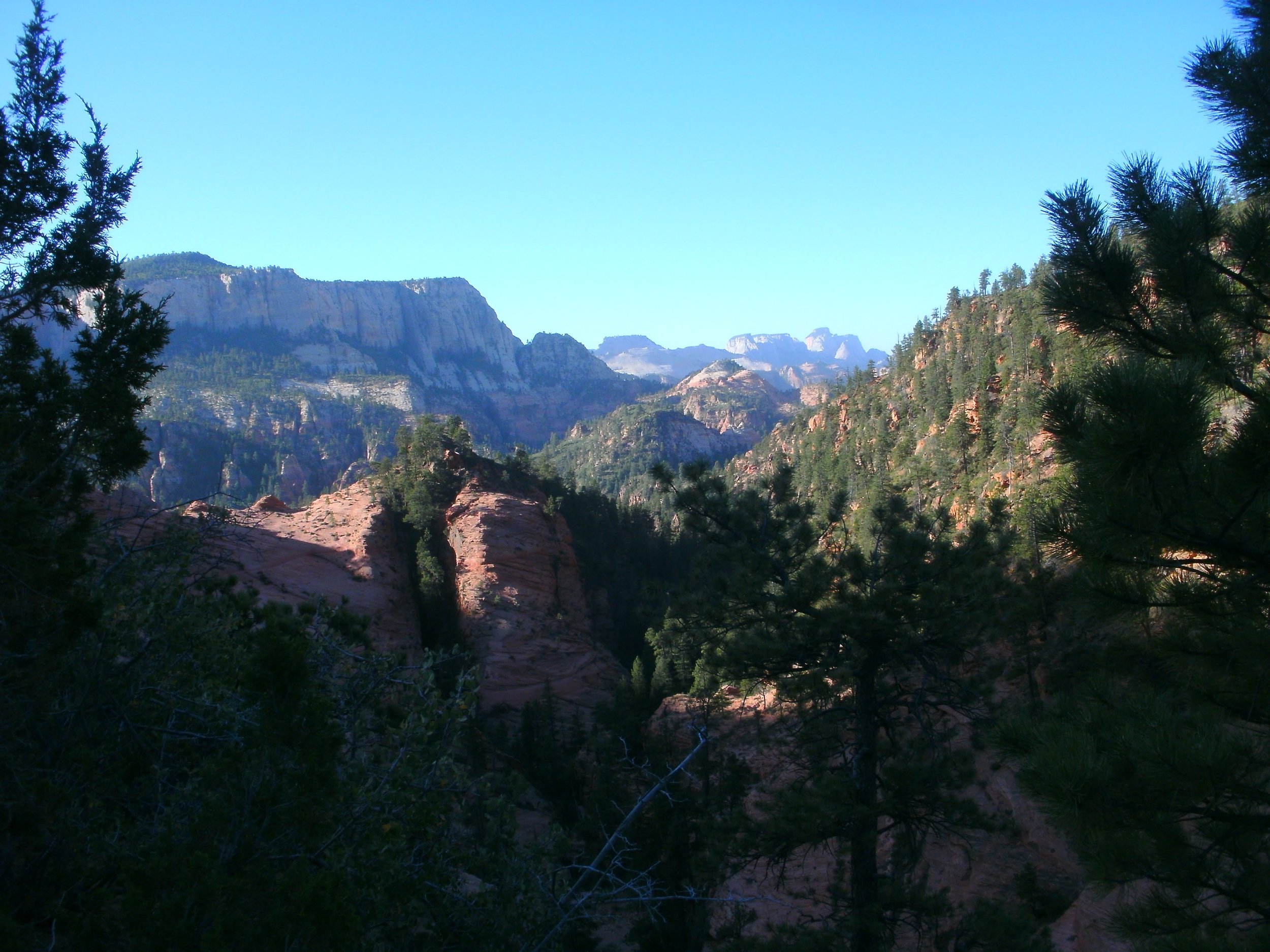
Trail view West Temple on Horizon. Copyright BrickBarnBlog2014
I unloaded my pack after arriving at the Wildcat trailhead around 7 am, with extended daylight hours and cool temperatures for today. Only one other car occupied a space. But before I could turn on my GPS and load my water, two more vehicles, crowded to the gills, pulled in and piled out. Time for fun in the Subway! Sometimes I worry about how unprepared people seem as I watch them get their gear and prepare to leave. The Subway is a main technical slot canyon in this remote section of the park. Technical canyons require ropes and harnesses to ensure safety; the group carried no helmets that I could see and were dressed in shorts and tennis shoes. Zion backcountry is no place to "experiment" with adventure.
I decide to beat the rush and head for the trail. As promised, it is a beautiful 55 degrees; only a few tracks are imprinted in the light rain speckles as I travel the maintained class 1 trail of Northgate Peaks and The Subway. After the second trail split, I begin to drop down the Subway trail. I hear voices behind me. The (more - much more) youthful group has caught up. It's not a race, and I continue to follow the trail. I'm not sure who guides their group, but they zig-zag around on different paths and never overtake me before reaching the Das Boot trail split.
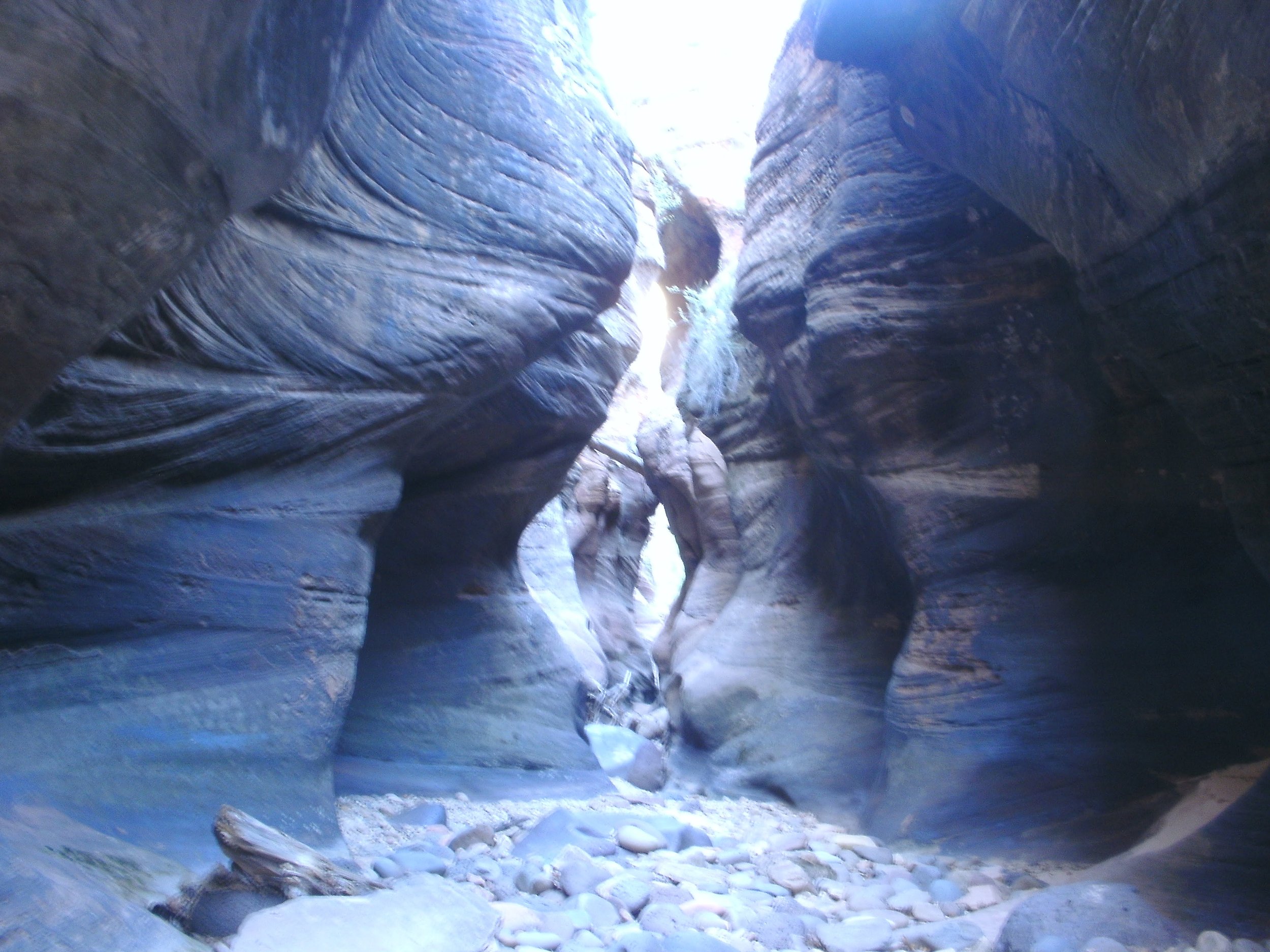
Das Boot Slot Canyon. Copyright BrickBarnBlog 2014
I follow the Das Boot trail (which is difficult) to the entrance. This section of the Subway is for experienced canyoneers only; a permit is required. Directly across and a few feet to the right of this wide section of Das Boot is a section of rock with a very narrow split. I climb up through the rift to exit on the opposite side of the canyon. I am following the shelf system southeast to the dryfall. I'm at the base of Rams peak and the rim of a deep slot canyon; this is a beautiful section of the hike, and I take a few minutes to eat a snack. There is water here. Having hiked Rams Peak before, I remembered this section as it is the final pool of water on the route and the stream has an excellent filtering effect. As the water travels beneath the sand, it connects with a layer of rock, the entire creek can be dry, and as long as there is water flowing out the other end of this area, the water is fresh and clear. Even in Das Boot, when the creek is dry, the potholes can contain water, but it is horrible-looking. This water is fresh and clean (as long as it continues to flow).
I relax; a big part of my hiking plan relied on this section to refill my water stores for the return trip. I stash a liter of water and plan on supplying as much as I need when I return from the summit. I'll carry about 3 liters to the top of Greatheart Mesa and back.
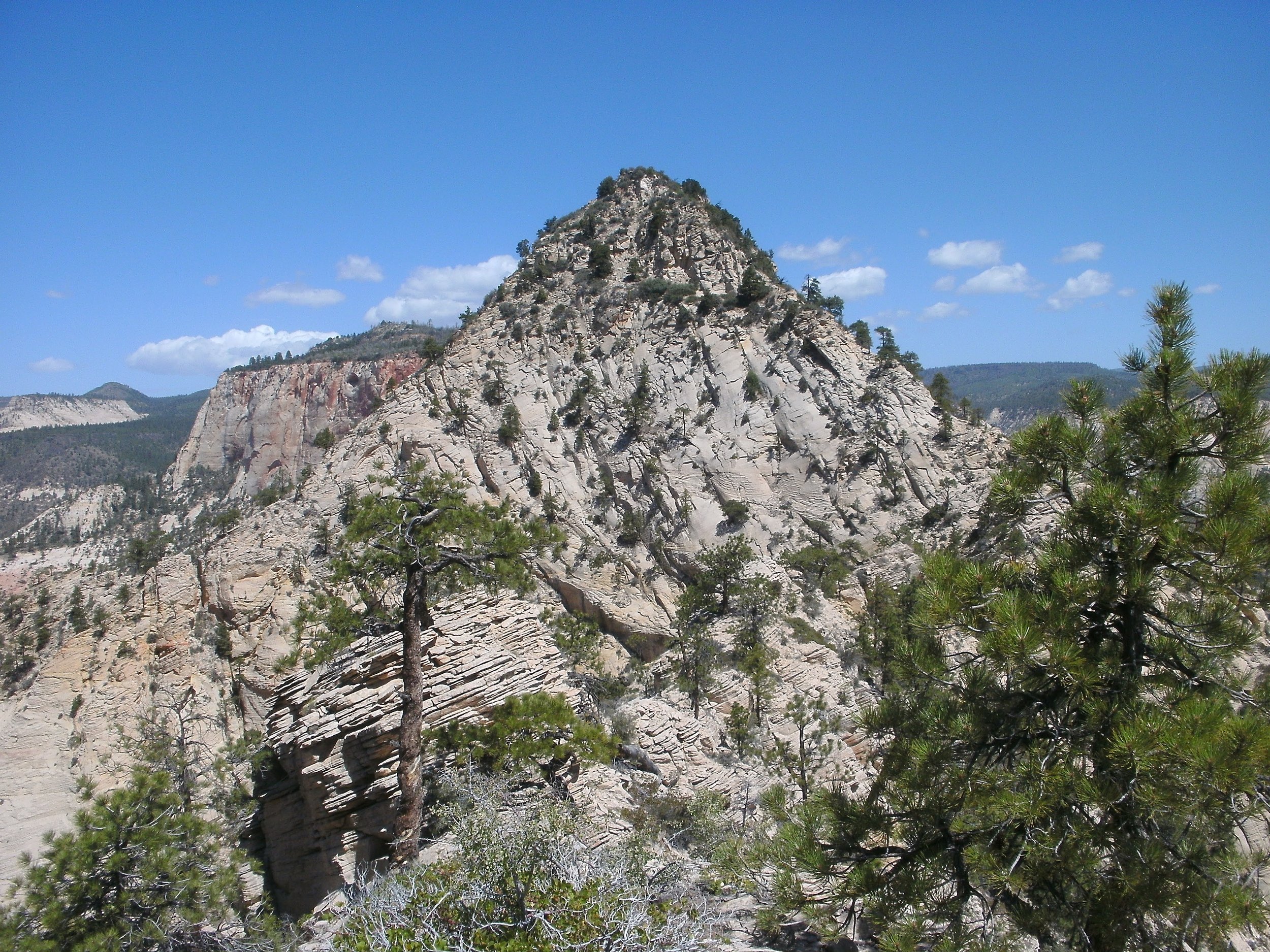
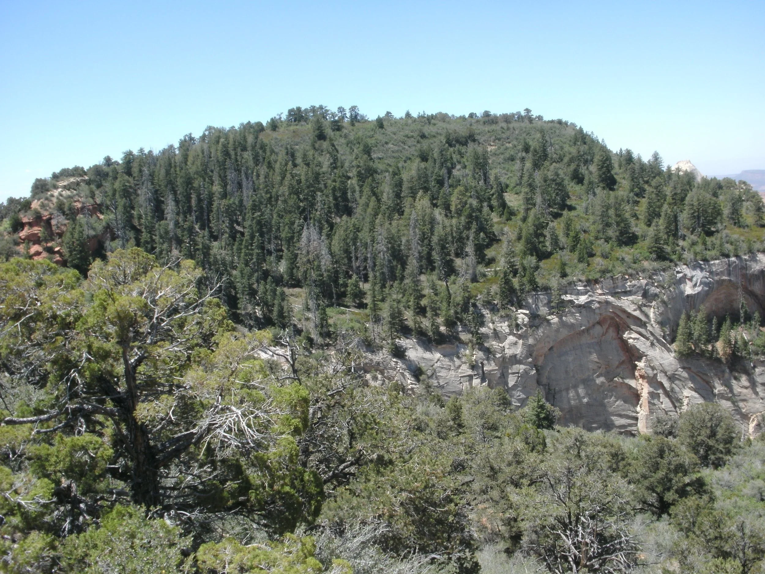
Ram’s Peak. Copyright BrickBarnBlog2014
Now the uphill climb begins. I follow the ravine and take the first wash on the right. To the north is an excellent "backbone" ridge line on solid sandstone. The backbone creates a charming hiking route and is the southern ridge line from Rams Peak. Behind the saddle is a hidden valley, and the whole of Greatheart Mesa is witnessed from this vantage point. I had planned on hiking the wash to the north and following the same route to the ridge line as I had on my Rams Peak route, but looking closer at the wash coming directly off very near Greatheart Mesa held promise. So I decided to see if the wash was clear enough to scramble.
So far, so good. Some minor bouldering, a couple of workarounds but nothing too tricky. A log jam created a crux to the upper area but was easy enough to climb over. The upper area is dirty, sandy and extreme choss to say the least. Be very cautious of holding or pulling on any boulder, regardless of size, if standing below. I was unaware of my strength as I dislocated several huge boulders that I would have thought impossible to budge.
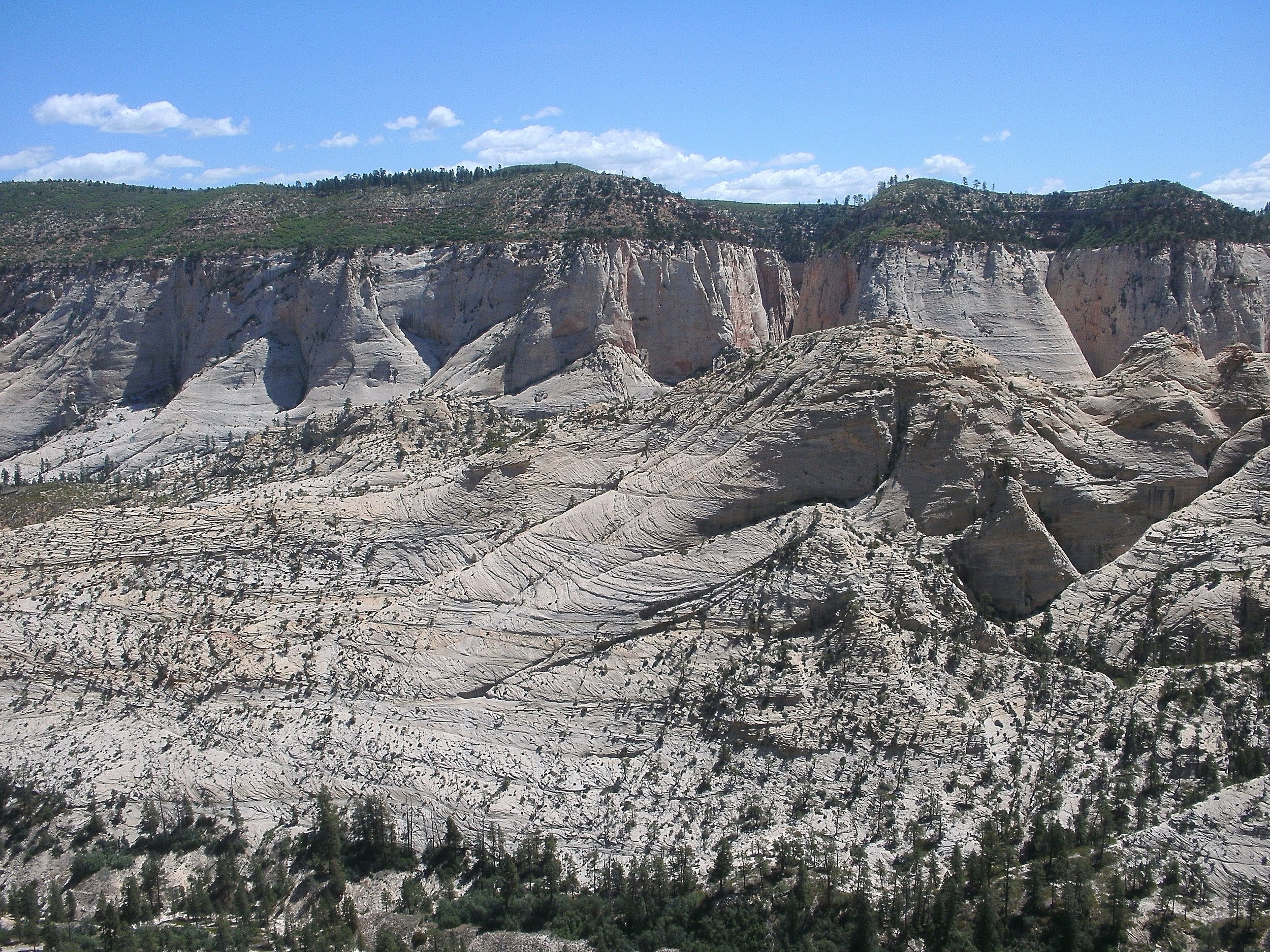
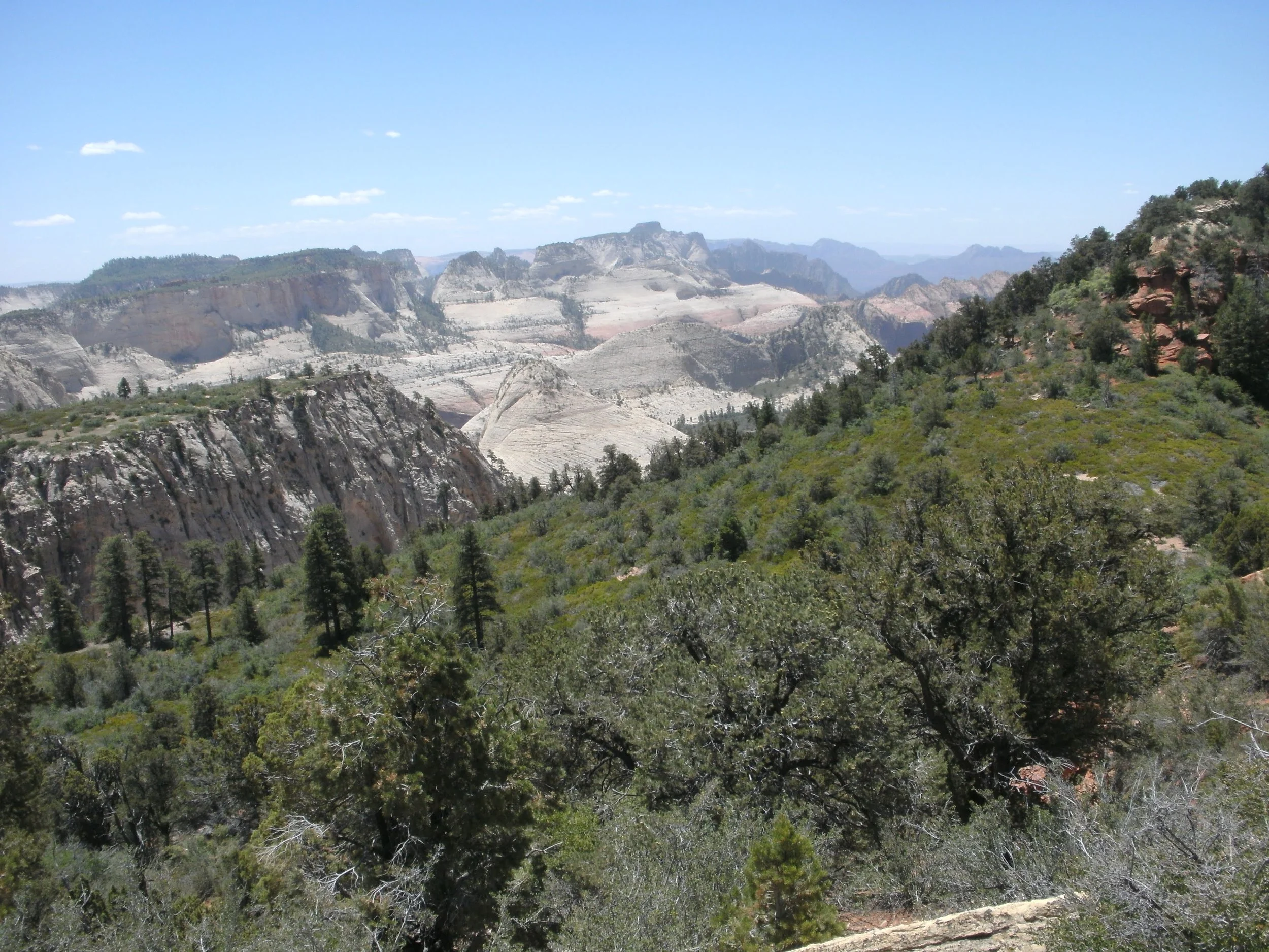
High Saddle Views. Copyright BrickBarnBlog2014
Reaching the high saddle/ridge line that connects Rams Peak with Greatheart Mesa is a beautiful sight. Views east are stunning in their remote splendor. I marveled (and worried) as I gazed west. The whole of Kolob Terrace is the horizon from north to south. Guardian Angels, Northgate peak summits, and Pine Valley Peak are all stunning to the eye. As I look back across that gaping expanse, the distance is more than a little troubling. I glance south and up the crux of Greatheart Mesa. The core is a narrow, dirty ridge line using trees and eroded rock as a weakness. A faint path is seen through the more protected areas, and the route moves to the western face for the final push. Several narrow crags offer access to the plateau, some class 3, some class 4, depending on which route you prefer—a bushy table at the top blocks all courses. I choose the crag at the further end, which has a small class 3 move and is dirt to a narrow entrance. The entrance has brush on both sides, which serve as handholds as I squeeze myself through the choke point and onto the plateau.
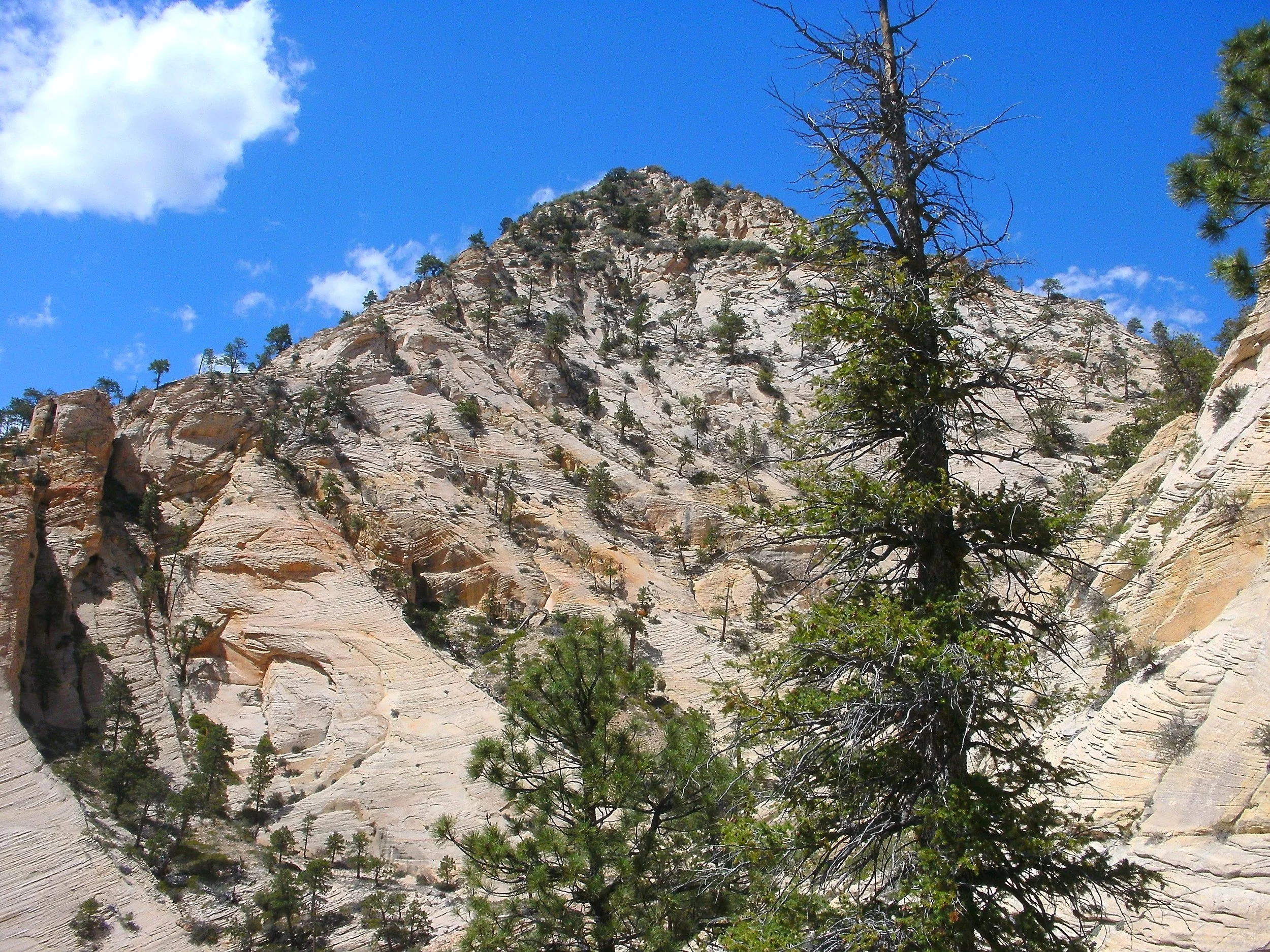
Bush Summit of Greatheart mesa. Copyright BrickBarnBlog2014
Awesome! I'm excited; the views are spectacular, the summit is still far away, and the brush is thick. Most plateaus have seen their fair share of lightning-induced fire, which makes hiking a breeze. Some have bushes, but game trails allow access; Greatheart Mesa has neither. Spread before me is a tangled mess of scrub, trees, and everything. I follow a faint path to a tree, and it ends. I step through the brush, another small clearing, but I'll take it and go on and on. From the time I break the plateau to the time I reach the summit is about 1.5 hours. By the time I reach the mountain peak, I don't care. I hate bushwhacking, and this has been miserable. The summit is a tree-enclosed highpoint with a small cairn of rocks; no registration exists. I take a couple of pictures. Log my time and turn around—what a mess. The plateau has taken way too much time and water. I push back to a clearing on the eastern side and find some shade with a view. I eat lunch, being careful with the amount of water I drink. Not good.
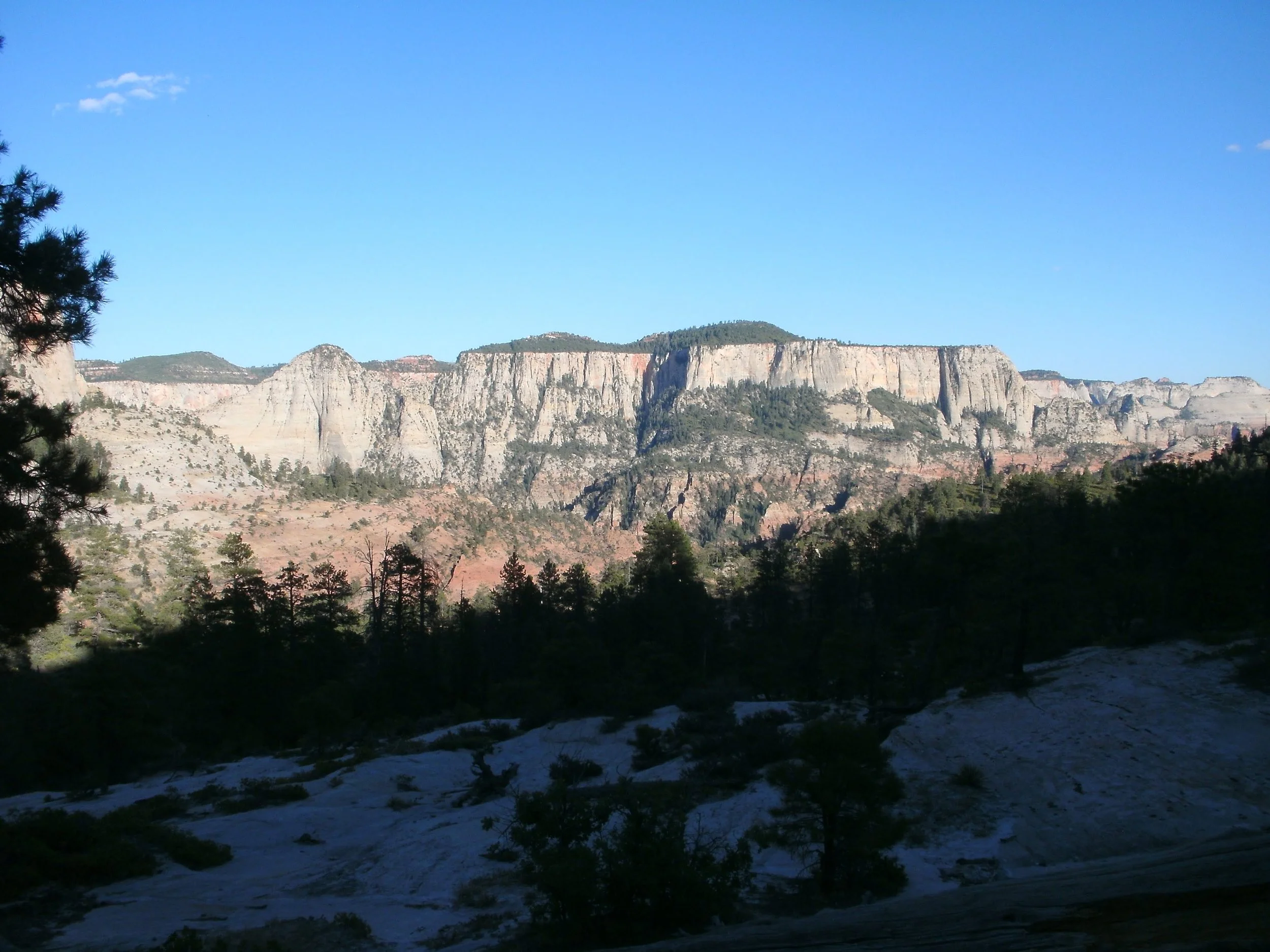
Greatheart Mesa view southeast toward West Temple. Copyright BrickBarnBlog2014
The view is enjoyable; I clean the twigs and dirt out of my boots. I check my water supplies and start again. Following my footprints made the return trip a little easier. Going downhill is always more manageable in the brush as the plant grows "with the grain." But it is still a significant pain; by the time I get to the end of the plateau, I have all but decided there is nothing "Great" about Greatheart Mesa. I have misjudged my water needs and have taken small sips as I descend the wash again through the hidden valley and down the Slickrock backbone. I'm now parched. I'm making good time, and thoughts turn to my secret water stashes and cool filtered plenty.
At the "oasis," I sip slowly from my stash. Take off my shoes and eat some energy snacks. Wow, that feels good. The filter comes out of my backpack, and I plan on getting at least 2 liters for the return hike. Nothing comes out; my filter doesn't filter any water. I work at it, tear it apart, and examine all the pieces. For some reason, the water is not getting through the ceramic core. Everything works, but the part I need the most. Not being able to restore my water supplies is a significant problem. I pour the remaining half liter into my Camelbak and start the long climb out following the Das Boot trail.
Base of Rams Peak. Copyright BrickBarnBlog2014
Sipping water only when I am thirsty, I start to boink. My muscle energy stores are gone. Sitting down, I take out some energy cubes and my final bar. I have emergency food, but it's not much use if I don't have anything to drink with it. I decide to eat and drink enough to wash everything down, even if that takes the last of the water. I need the energy for the climb out. Thankfully, I have plenty of water back in the Jeep. Thankfully, my snack doesn't take all my water, but it is close. Before I reach the halfway mark, I'm totally out of water. I drain the little water left in the reservoir by twisting the cap. At least the night air is cool. The sun has moved behind the ridge, and the hiking is pleasant. I methodically hike and smile. It has been a good day. I'm thirsty and partially dehydrated, but I feel strong; the energy cubes and bar have given me what I need to finish the hike.
Final look at Greatheart Mesa. Copyright BrickBarnBlog2014
As I reach the central plateau and Northgate Peaks trail, the sun is very low on the horizon. As I walk the long path back to the trailhead, a light breeze blows. Waiting for me in the Jeep is two bottles of water on ice. I slowly sip at the first one and dump the cool water on my head. I would drink both bottles between the trailhead and the local gas station in Hurricane. I bought two Gatorade bottles at the gas station, a large coke with chips, and a turkey wrap. The "outdoor" seating was pleasant as I chugged one of the Gatorades and half the coke. Not hungry, I nibbled at the wrap—what a day. Lesson's learned involved checking my equipment even if the last time I used it, all worked okay. I'm sure my feeling about $#%@# Greatheart Mesa will fade, but if you are looking for a fantastic out-of-the-way peak to climb some fabulous summer day. I'd choose something else.