
The rock club of Cedar City, UT, is heading out again this weekend. This time to Tonopah, Nevada. Now for those of you who, like me, have never been to Tonopah, it truly is in the middle of absolutely nowhere. However, as we made the long drive, I've never been so happy to see a place as I was pleased to see Tonopah. Unfortunately, we forgot to top off the gas tanks in Calantie, NV, and with a little more than 50 miles to go, Sean informed us that he had 1/8th of a gas tank remaining. With thirty miles to go, the gas gauge read empty. Thankfully, the diesel truck pulling the trailer was projecting 80 miles left in our tank simultaneously, so Sean tucked the jeep in behind the trailer to draft as much as possible. Turning into Tonopah with the jeep still running (at least on fumes), we pulled into the nearest gas station. As these things go, it was a nerve-racking few miles.
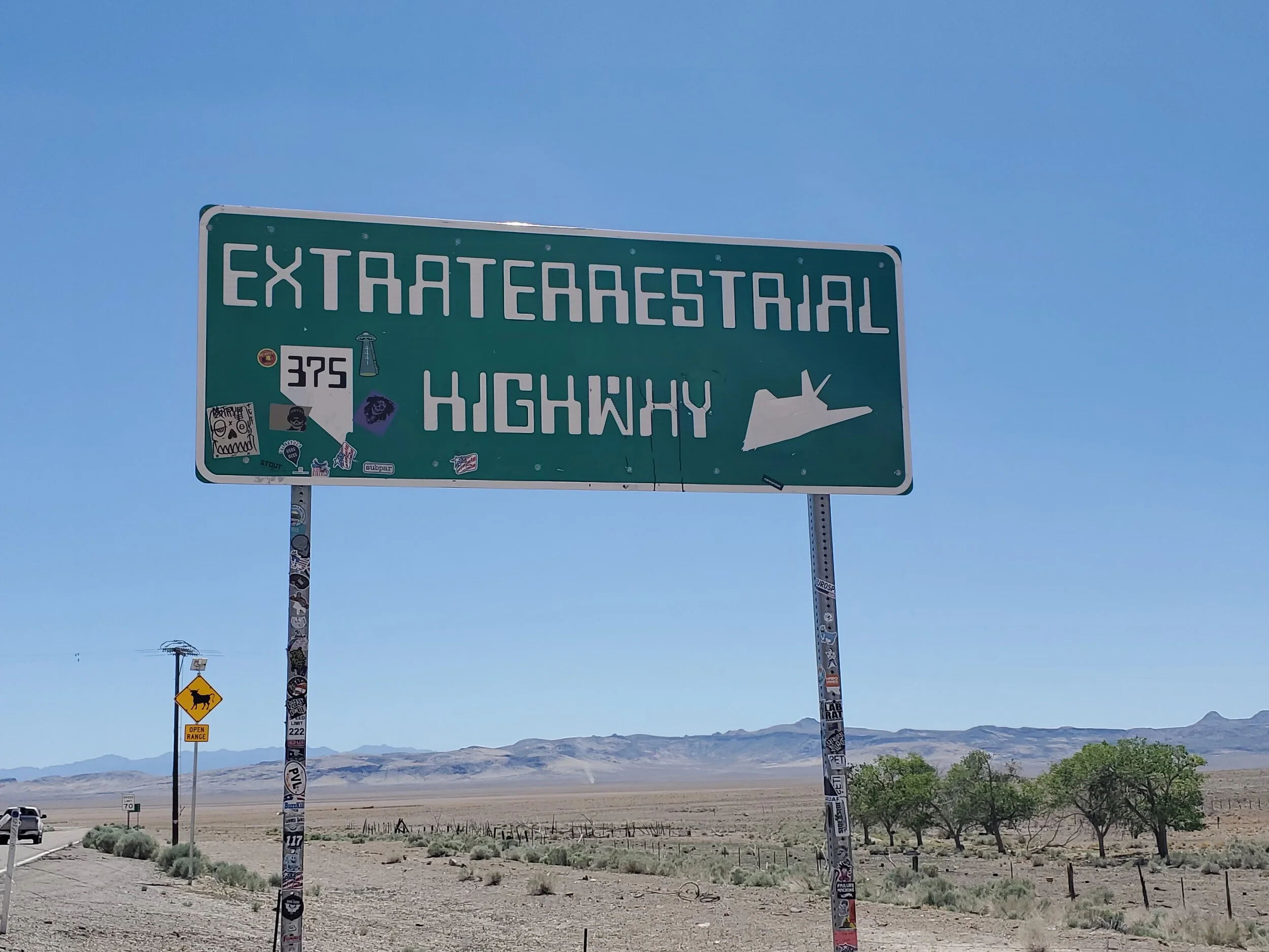
NV-375
We rented overnight trailer parking at the Tonopah Hospitality and RV park. As camping sites go, it is modest by even the best of standards. A line of hookups for the weary traveler is fine with me, but I miss the open range camping without highway noise. Dinner at the Tonopah Brewing Company and BBQ was excellent. The single waitress serving the entire eatery was worn thin, but the meal itself was fabulous. We opted for the family platter with the three of us extremely hungry (dinner for 4); we ate all we could. Bagged the rest, and two days later, we are still eating leftovers. The meal for four could easily feed a family of 6, possibly eight.
Early the following day, Linda and Sean headed toward The Sump. The Sump is a unique geological formation in this section of western Nevada whose history spans millions of years. Prehistoric lake, volcanic activity, and wind with water erosion have resulted in an area of canyons, spires, and semi-petrified trees. [1] I take the truck, quad, backpack, and maps as I head out to locate some of the Tonopah - NV quadrangle peaks. There are 18 listed mountains in the quadrangle; 12 ranked peaks with a rise of 300' feet or more. Mining is very active in this area, so I need to find a mountain to climb without trespassing on an active claim. I eventually find myself north of town in an active ATV area, looking at the western face of Ararat Mountain. Two mine tailing piles dot the hillside about halfway up the slope, and I have a downloaded GPS track for the climb. I review the site and decide this is as good as any peak to start the day.

Ararat Mountain
Rocky desert peaks are beautiful in their own right as I cut across sagebrush and wild grasses to follow a telephone pole path. The way cuts back toward the mine, and I leave the road to start my ascent just north of a prominent wash on the hillside. Ararat Mountain hillside is predominantly scree from the broken and chipped boulders dotting the hillside as I climb up the face. I follow the more gentle way cutting across the terrain to meet the ridgeline at a high saddle, from there a walk along the eastern ridge to the summit. Even in June, the 6,664' of elevation is cold in the morning light. The sun is up, and so is the temperature as the day wears on; I decide not to linger on the summit. There are four peaks in the immediate area, and a fifth peak a short ATV ride away. I want to summit all five mountains today.

Ararat Mountain summit view south-southwest. Mount Oddie (foreground), Mount Butler background (center) and Brougher Mountain (picture right).
I drop off the mountainside, angling to get a good look and the mine on my way down. Back at the truck, I move to a new parking location and unload the quad. Following the road back past Ararat Mountain, I ride to a saddle between Mount Oddie and Rushton Hill. Rushton Hill was a significant source of a mining operation at some point in history. I park the quad next to the cement mine shaft and walk to the top of Rushton Hill. I've been eying the road to the top of Mount Oddie from the summit, but with the loose scree, steepness, and narrow path, I decided against riding my ATV to the top and started walking instead.

Rushton Hill. Cement mine entrance (picture left)
The path is indeed steep and narrow. I can avoid any slips in the loose scree with my hiking poles, and I am glad I decided to hike instead. The view of Tonopah is stunning, rounding a sharp turn that looks directly down onto the town. A lone dog has been barking at me from the hillside neighborhood, and I turn my back on him to keep hiking up the road. Another sharp turn, and I reach the summit.
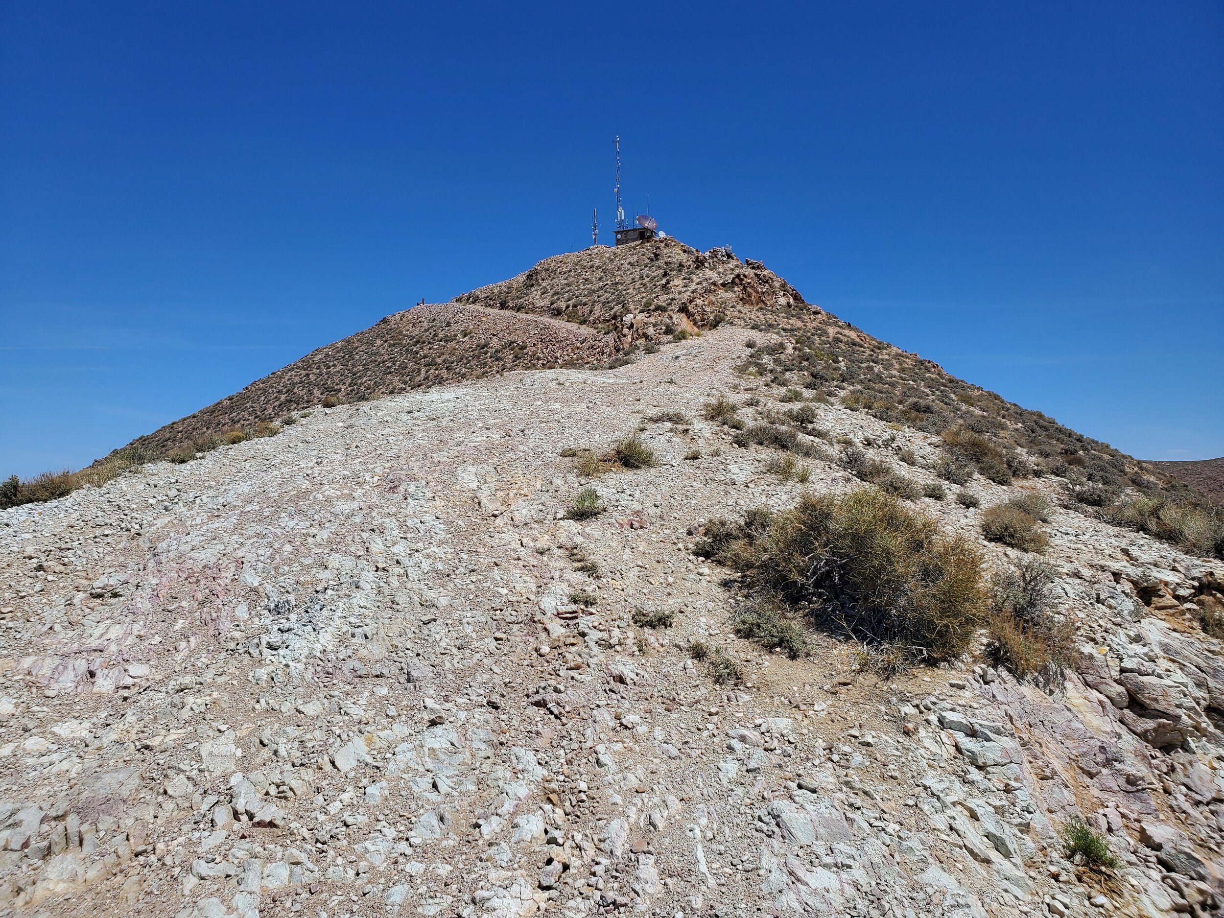
Road view of Mount Oddie
Mount Oddie's top has been bulldozed level to hold the communications towers that exist here, yet an outcropping of rock signifies the current apex of the mountain. I scramble to the top and stand next to a power pole marking the summit.

Mount Oddie high point
Three peaks down, I decided to summit the minor unranked peak of Mizpah Hill. This bump in the road is one of six such little mountains in the Tonopah - NV, quadrangle. When I'm able, I enjoy the short ascents to the top, which also helps me to complete the entire quad of peaks. Complete with the fourth peak, I debate whether to ride the short distance to another peak when I receive a text from Linda that they have returned to the trailer for lunch. That sounds like a good idea.

Mount Oddie summit view east. Mizpah Hill (picture center) and Rushton Hill (picture right) and US-6
A CalTopo map of the area can be found here.