
Bushwhacking: present participle of bush-whack (verb) 1. Live or travel in a wild or uncultivated country: "seven days of bushwhacking." 2. Cut or push one's way in a specified direction through dense vegetation: "he'd bushwhacked down the steep slopes."
After another day in the Kolob Terrace section of Zion National Park, I might add a number 3. The slow death by a thousand cuts. I'm pretty sure I am solely responsible for the spray antibiotic companies staying in business.
Today's my birthday, and like similar birthday challenges, I had identified five peaks in the area, which totaled at least 5500 vertical feet. Parking at a small pullout just south of the gated dirt road leading off the Kolob Reservoir Road and along the hillside of Firepit Knoll (I would recommend hiking down the dirt road), I followed a well-worn path along the cliff belt. The trail had beautiful views to the west as elevation increased, but the path soon faded, and I had to "push my way through the dense vegetation" to get back to the road — not the right way to start the morning.
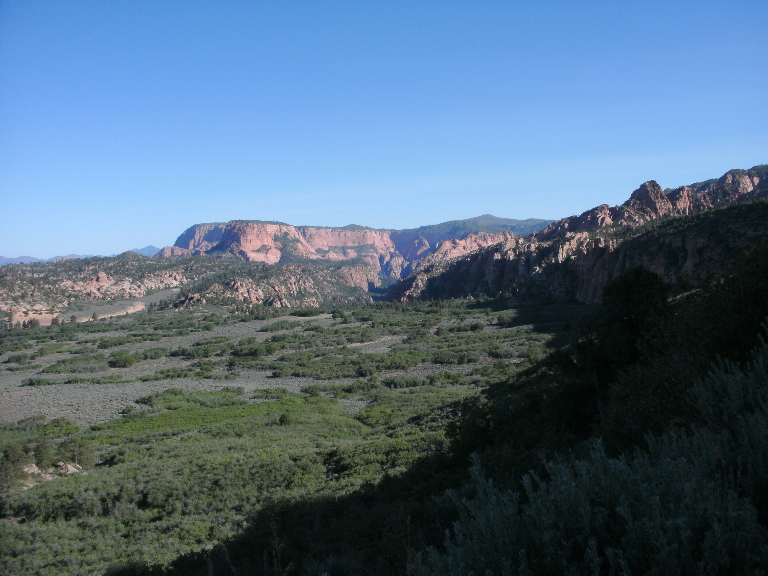
Trail view north
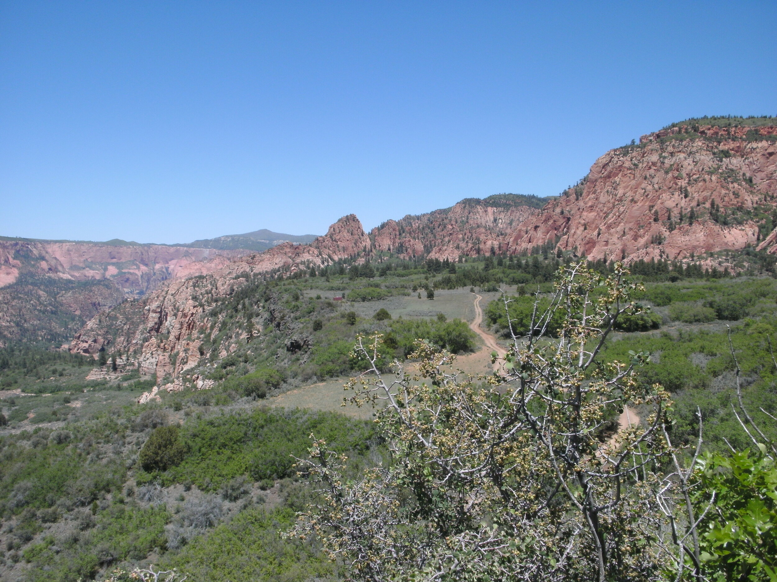
The road hiking is pure class 1, and the high plateau is level and clear. The view west is breathtaking. Just before reaching a small cabin, I move off the road and out into the field, keeping a reasonably straight line, bypassing the structure. Dropping off and into a wash, follow the gully to the west, until Slickrock. The Slickrock provides convenient hiking north for a short distance. I continue moving north along game trails and washes, which keep the bushwhacking to a minimum.
The day is beautiful and the air crisp, but I soon realized that I had hiked beyond my intended target of Peak 7480. However, a non-ranked peak, known as Peak 7420, is close by, and I figured I might just as well climb this peak. Peakbagging these two proximity peaks before heading back. I studied the TOPO and decided I could climb the rise in front of me, and then the central peak would be behind and to the west.

Peak 7480
As often as I have hiked in Kolob, you'd think I would be smarter than that. Nothing in this rugged country is "simple" or "easy." Upon reaching the high, rocky, formation of the ridgeline, it quickly became clear I was not going to be able to get into the next ravine, nor could I climb the wall on the other side. I sat on the tallest section and ate a snack. This area is so beautiful; after reviewing my options, I decided to descend a very steep but sandy ravine below me and try the next wash over. Slipping and then sliding down the sandy shoot, it became the first of three such butt slides for the day.
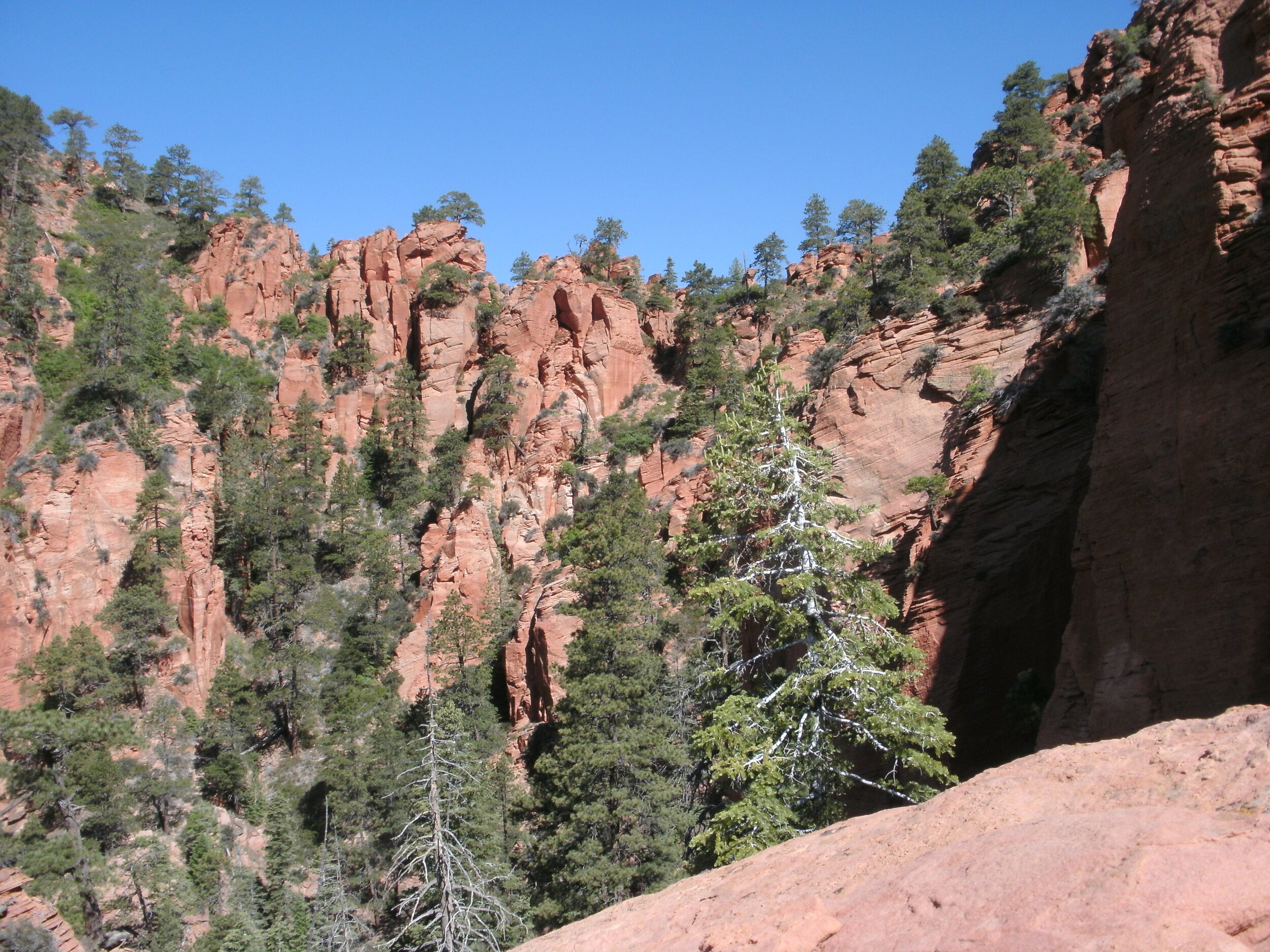
Rocky Ridgeline
The second wash I reviewed was blocked, but the third was excellent. Another steep, sandy, but broad gully led to a high saddle. The views into the rugged backside were gorgeous. I started up the crux, and thankfully, decided to review the TOPO once again. I noticed I was still trying to climb the minor peak on the eastern face when my new position made it possible to scramble directly up the central summit. I am heading in the wrong direction.
Reversing back across the saddle, I surveyed the wash. Definitely class 3, I slung my hiking pole and started to climb. Moving to a pine tree that splits the wash, I move left. I anticipate an easier climb up and around to the ravine on the right. The right side doesn't work, so I backtrack to the tree and start over. Moving left this time, I did my best to stay out of the sand and work the rocky ridges for better traction, and this worked well. In typical Zion fashion where bushes grow out of the solid rock, several moves involved bushwhacking on the ridgeline. Weird. The upper summit is sand, and very steep, using clumps of grass and hand-dug footholds I made my way to the summit — absolutely stunning views in all directions. A tiny summit cairn exists but no registration jar.

Summit view north

Summit view south. Firepit Knoll and Spendlove Knoll in background.
Moving back off the peak, I was tired. So much for bagging my birthday limit today. I had been keeping an eye on Firepit Knoll on the hike back along the road, hoping to spot a trail to the summit. Firepit Knoll, along with its sister peak of Spendlove Knoll are cinder cones, and both ranked peaks in the area. I figured that fact alone would provide an excellent trail to the top. Not so, but game trails do exist. While deer and elk are large enough to make excellent trails through thick brush, they are inconsiderate in their direction of travel. It became necessary to push from one path to the next through the very dense foliage.
Game trail view north.
Firepit knoll summit contains a cairn, which according to my GPS is off from the true summit, I wandered around looking to see if I could find a survey marker or any other cairns but couldn't. The firepit is exciting, and I wonder what prevents vegetation from growing in the bowl. Pushing directly off the western face, I find fewer bushes and would recommend using this as the ascent route.

The “bowl” of Firepit Knoll
Back at the car, I head to my favorite Springdale eatery. If I can't bag more peaks, I might as well eat some of the best carrot "birthday" cake on the planet at Oscars.