
Last year, I received as a gift a hiking book entitled "Wow Guides: Utah Canyon Country". It was a nice and thoughtful gift. I flipped through the cover and noted a few of the hikes I had done in and around Zion National Park, and promptly delivered it to my shelf. I receive my greatest joy standing on a mountain peak, hiking long and mostly boring trails just never had much appeal to me. But lately I've had a change of heart. Two things I think have contributed to this change of direction in my outdoor activities. First: My first love will always be mountain peaks, but they are becoming increasingly hard to plan for, drive to, find the route to the top, and return in a single day. Many of the remaining peaks in my local area, are simply grassy or wooded knolls, many on private land. Many do not have trails to the top, and therefore I can spend hours pouring over TOPO maps to try and figure out a route, only to have the on site situation be different. In truth, I've grown tired of all the pre-planning required to summit some of my remaining (close) peaks.
In trying to decide what I wanted to do this weekend, I turned to the Wow Guide. It is hot and windy. So I was looking for something at altitude, close by, and something I could just hike. No pre-planning, no thought, just a nice stroll through beautiful country. Trip 18 Red Canyon seemed like the perfect plan.
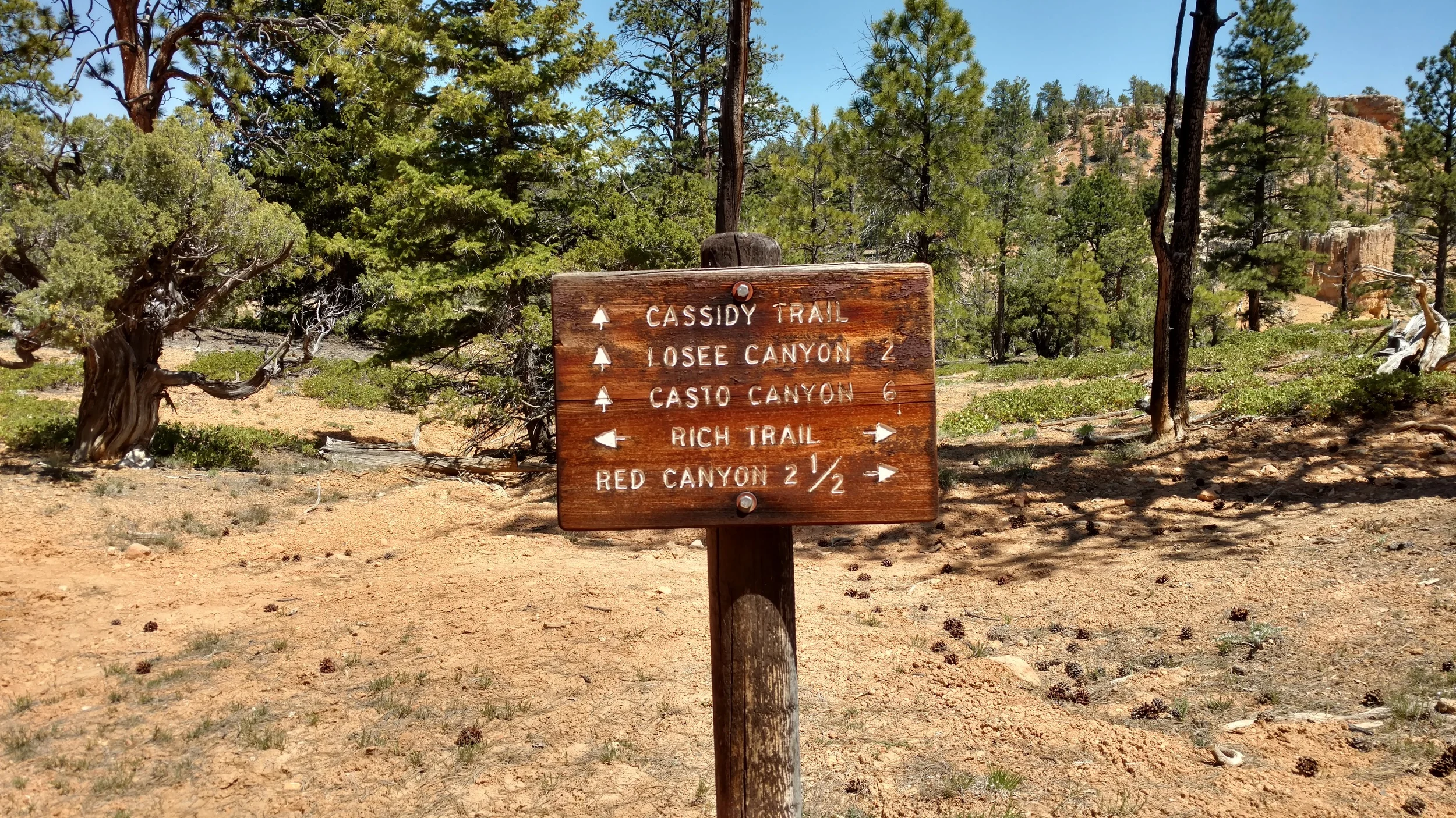
Red Canyon is the stunning canyon on the way to Bryce Canyon. It is iconic in its own right, having many pictures taken of the two small tunnels that exist in the canyon. It is often overlooked and disregarded as travelers make their way further down the road to Bryce. Turns out Red Canyon is a hikers dream. The guide gave me directions to Losee Canyon, turning north just before Red Canyon and driving a couple miles to the trail head. When I arrived, 5 cars awaited me in the parking lot. None from Utah. Perfect.

Losee Canyon Trailhead
It was evident from the start that this was going to be a beautiful hike. Losee Canyon trail follows the wash due west for 3 miles. Also just off this trailhead is a short .7 mile Arches Trail to a prominent group of sandstone windows on the ridge. The Arches Trail will have to wait for another day.
The trail starts just behind the information sign and wanders through some Pinion and Juniper pine trees before connecting with the wash. The trail is well marked and easy to follow as it moves from wash to side to side and back to the wash again.
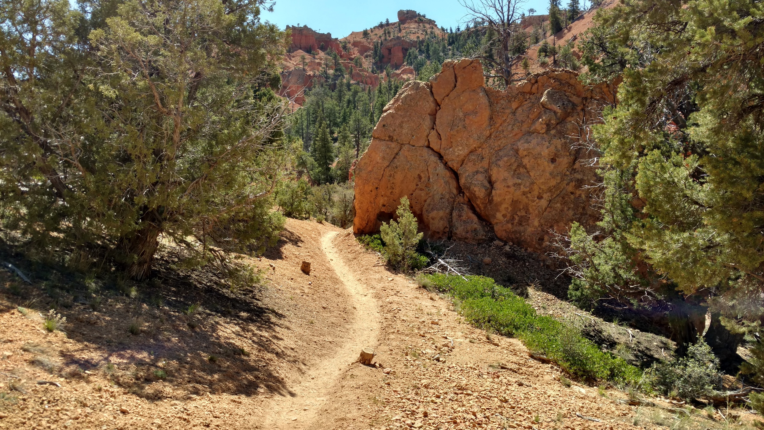
Well used trail
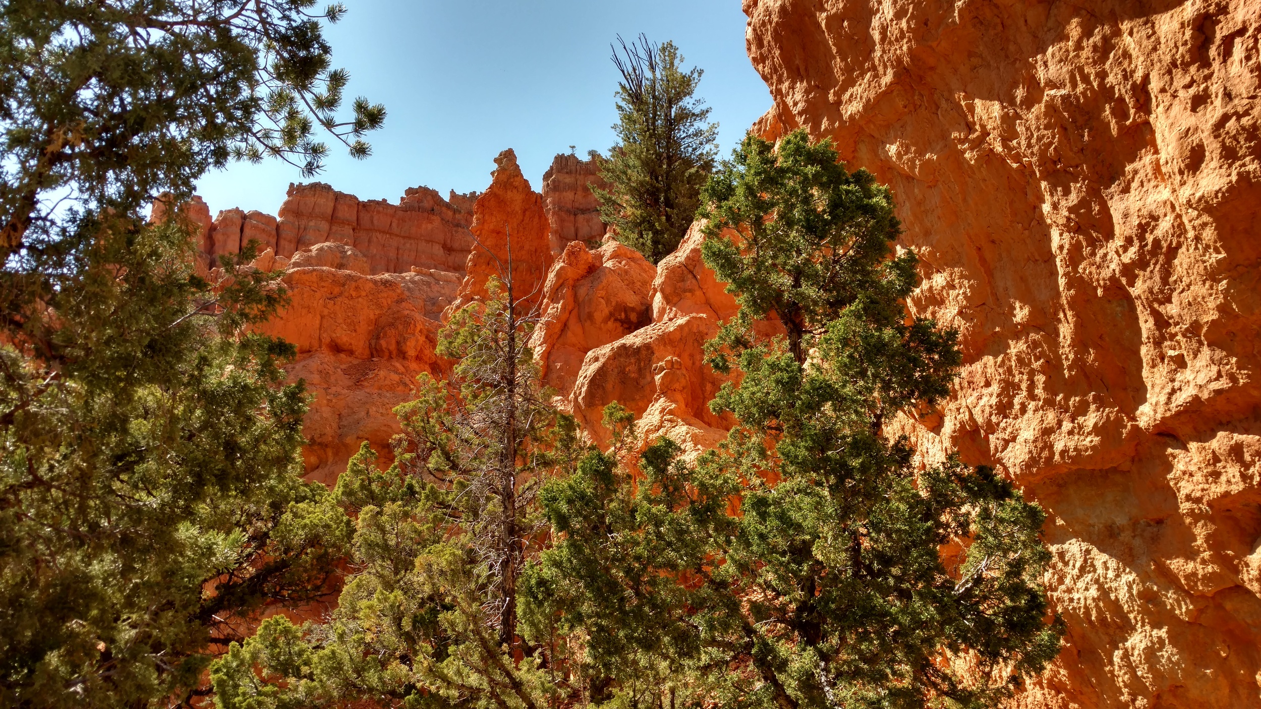
The hike is enjoyable and I meet only a couple of people, most are headed back down the trail already, meaning they either got a very early start, trying to beat the heat, or they turned back somewhere along the trail. The deep red rock and hoodoos mark this as an incredibly beautiful place.
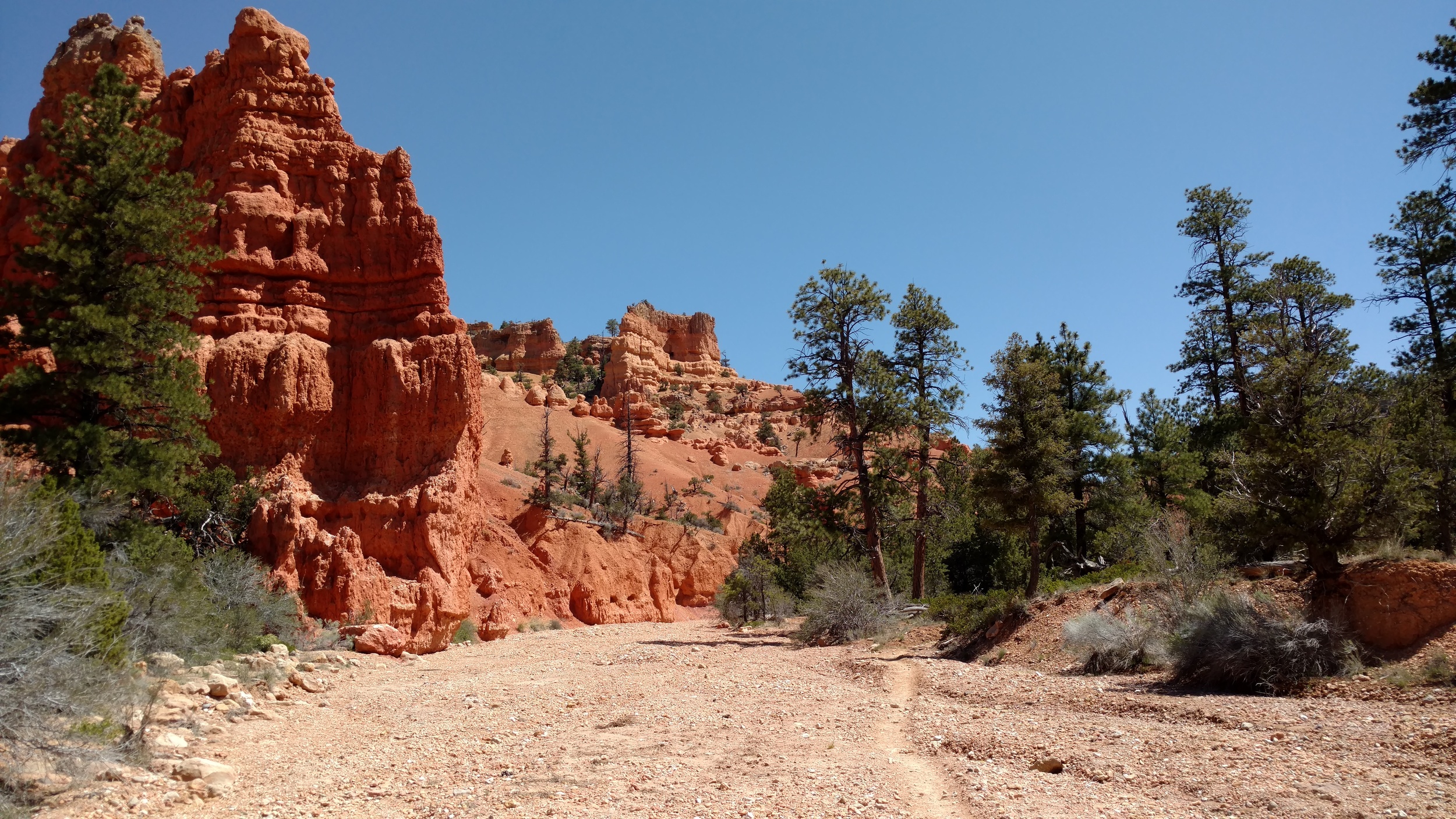
Losee Canyon Trail

Trail view of Hoodoos
At the head of Losee Canyon is a confluence of trails, corrals, and an outhouse. The sign says 3 miles to the trailhead, my GPS has logged almost 3.5 miles. The hike has been beautiful and I check my water supplies, deciding to follow the Cassidy Trail back to the south.

So far the hike has been easy, with little grade up the gentle stream bed of Losee Canyon. Turning onto the Cassidy trail, I begin my ascent out of the canyon heading for higher ground. The trail is steep in sections, as it climbs toward the plateau, and although shaded by the towering Ponderosa pine trees, I begin to feel the heat for the first time today. Breaking out onto the high plateau, the trail wanders along a grassy, rolling, hillside, wandering south, then west and back toward the south again.
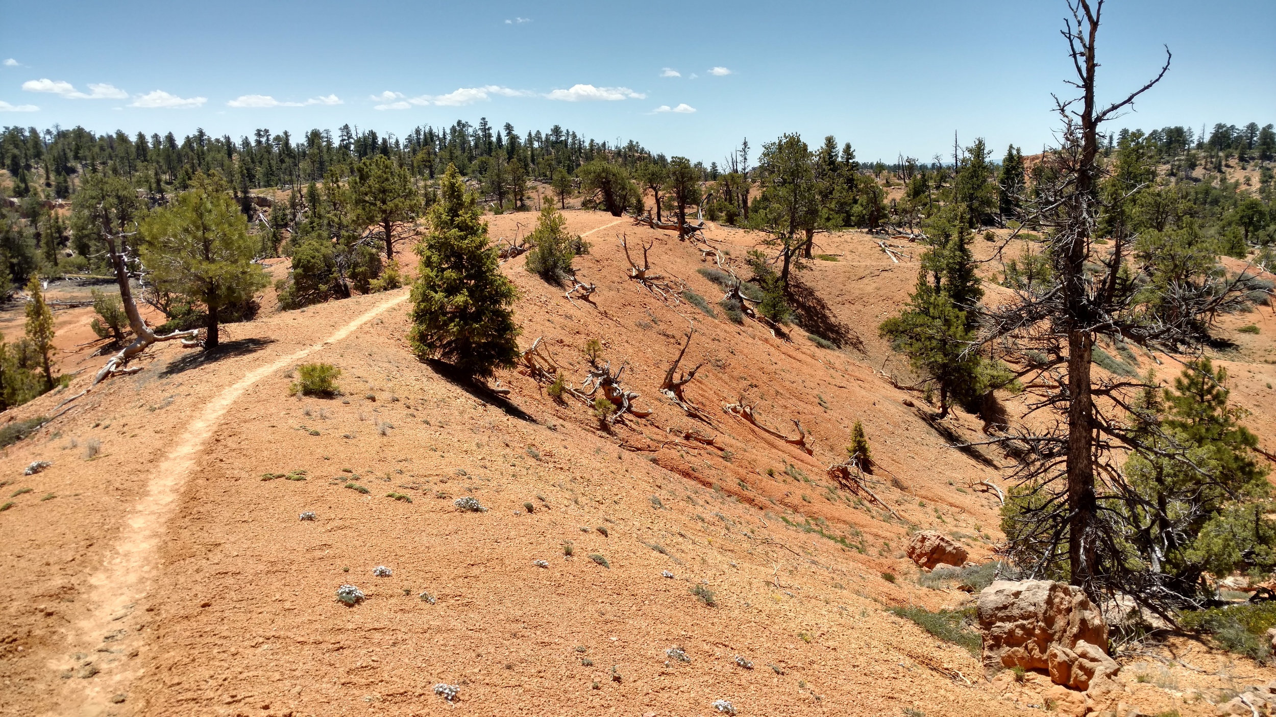
Cassidy trail
I begin to understand why the "Wow guide" referred to this area as a hikers paradise. The rolling red knolls, create a lattice work of trails which are well marked and labeled. I cross the Rich Trail and note on my map that I will connect with the Rich Trail again, creating a figure 8 loop here on the plateau. I'm beginning to feel the heat and my feet, so I decide to take the next leg of the loop to begin my trip back.

Cassidy trail marker
I'm a little surprised by the next trail marker sign as I consult my map again. I'm only 2 miles from the Red Canyon trailhead which is near the Red Canyon visitor center, but I'm about 7 miles from my car. Brayton Point is the loop I had determined to take, but I toyed with the idea of hiking to the visitor center then back to my car that direction. Unless I could catch a ride, it would be a very long hike indeed. I decided to stick with my plan and turned toward Brayton Point.
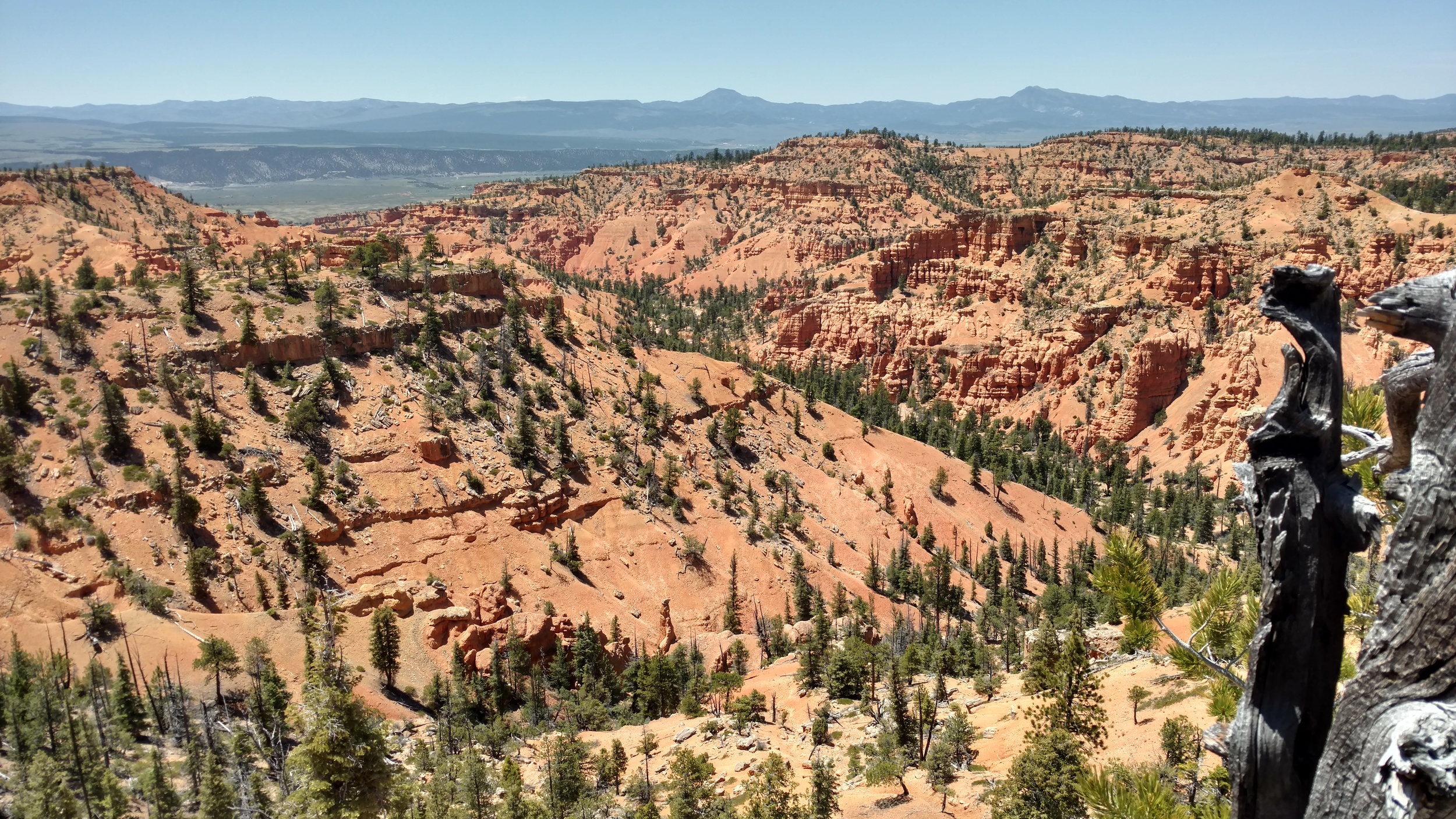
Brayton Point
Brayton Point is a stunning lookout point complete with corrals and logs for sitting. I make my way toward the rocky end of the point and find a shaded rock to sit under to eat my lunch. What a beautiful view. The view is of Losee Canyon, and as my eye catches the trail below, I begin to calculate my return trip by trail, or by dropping off the rim and taking a shortcut. The surrounding hillside is steep and rocky. Several cliff bands wrap the hillside and I spend a good deal of time looking at several alternatives.

Brayton Point, view of Losee Canyon trail
In truth, any number of the alternatives I considered would probably save me several more hours of hiking and drop me safely into Losee Canyon and back to my vehicle in record time. I decided against these alternative for the simple fact it was off my intended route and as a solo hiker that is always a very dangerous proposition. The hillsides were also pristine and I hated to mar them up with my footprints. If found, I would follow a trail to the bottom, but nothing of note came to my attention on the return hike.
Crossing the Rich Trail once again, I turn left, to complete the figure 8 loop. The Rich Trail, is a less traveled trail, that loops up and along the rim of Losee Canyon, it is short, but provides another perspective into this beautiful countryside. A rugged and sparse landscape of rock and scree, I wasn't surprised to spot a Bristlecone Pine tree not far from the trail. These extremely long lived species seem to thrive in harsh weather and bad soil.

Bristlecone Pine
Connecting again with the Cassidy Trail, I am now back on familiar terrain. Dropping back into Losee Canyon, I travel along the lonely trail in the late afternoon sun. I haven't seen a single person since early this morning. One of the simple pleasures of hiking. The changing angle of the sun has made the rock formations in Losee Canyon take on a different hue than the morning glow and I am again mesmerized by the deep red color, even more prominent by the suns setting angle.

Losee Canyon
The screech of a Raven, reminds me just how quiet my surrounding have become as I approach the final turn of the journey. Only one car remains in the lot, and it is one of my favorite sights to see, knowing I am the last one out of this beautiful countryside.
Losee Canyon